| P number: | P202545 |
|---|---|
| Old photograph number: | A02597 |
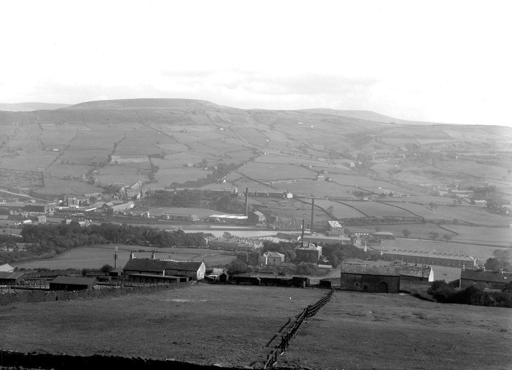
| Caption: | About 3/4 m. NW of Rawtenstall. Looking E-S. |
| Description: | About 3/4 m. NW of Rawtenstall. Looking E-S. A2596 forms panorama with A2597 and A2598. A2596. Top of Bank Farm in left foreground - Rawtenstall in centre middle distance with Rossendale stretching away eastwards towards Bacup. A2597. Looking towards Whitaker Pasture (on left) and Whittle Pike to right of centre background. A2598. Horncliffe Quarries on left. Grant's Tower to left of centre background. Looking south down Irwell Valley to Ramsbottom. The Naden Valley fault runs on the left of Whittle Pike and to the left of Horncliffe Quarries. On the left of this fault beds from Fletcher Bank Grit (in valley at Rawtenstall) to Upper Haslingden Flags on Cowpe Lowe are seen. On right of fault - Whittle Pike is capped by Bullion Rock and thence downwards Rough Rock plateau, Haslingden Flag features continue succession to Brooksbottom Sandstone in valley - middle distance. |
| Date taken: | Wed Aug 01 00:00:00 BST 1923 |
| Photographer: | Rhodes, J. |
| Copyright statement: | Crown |
| X longitude/easting: | 380500 |
| Y latitude/northing: | 424500 |
| Coordinate reference system, ESPG code: | 27700 (OSGB 1936 / British National Grid) |
| Orientation: | Landscape |
| Size: | 154.23 KB; 1000 x 722 pixels; 85 x 61 mm (print at 300 DPI); 265 x 191 mm (screen at 96 DPI); |
| Average Rating: | Not yet rated |
| Categories: | Unsorted Images |
Loading...
Loading...
Reviews
There is currently no feedback