| P number: | P000407 |
|---|---|
| Old photograph number: | C01474 |
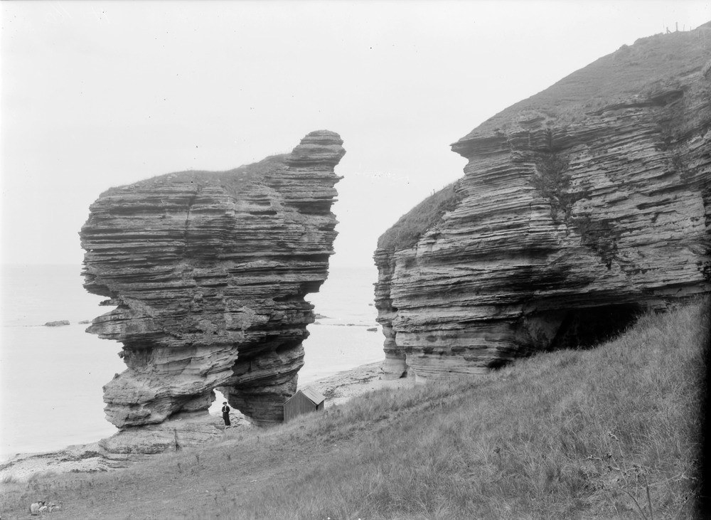
| Caption: | Shore at Covesea, 6.0 km. west of Lossiemouth. Morayshire. Sea cliff and stack of false-bedded yellow Triassic sandstone both of which have a capping of boulder clay. On the right is an old sea cave now well above high water mark on a raised beach. |
| Description: | Shore at Covesea, 6.0 km. west of Lossiemouth. Morayshire. Sea cliff and stack of false-bedded yellow Triassic sandstone both of which have a capping of boulder clay. On the right is an old sea cave now well above high water mark on a raised beach. The stack now isolated from the main headland formed when wave action on the joints and master joints on either side of a headland created caves. The caves would eventually join to form an arch. Subsequent collapse of the arch would leave the stack isolated as in the photograph. Note the formation of an arch on the stack. |
| Date taken: | Sat Jan 01 00:00:00 GMT 1910 |
| Photographer: | Lunn, R. |
| Copyright statement: | Crown |
| Acknowledgment: | This image was digitized with grant-in-aid from SCRAN the Scottish Cultural Resources Access Network |
| X longitude/easting: | 317500 |
| Y latitude/northing: | 870500 |
| Coordinate reference system, ESPG code: | 27700 (OSGB 1936 / British National Grid) |
| Orientation: | Landscape |
| Size: | 181.23 KB; 1000 x 731 pixels; 85 x 62 mm (print at 300 DPI); 265 x 193 mm (screen at 96 DPI); |
| Average Rating: | Not yet rated |
| Categories: | Best of BGS Images/ Images from the archives, Geoscience subjects/ Structural features/ Jointing, in sedimentary rocks, Geoscience subjects/ Landforms, marine/ Stacks |
Loading...
Loading...
Reviews
There is currently no feedback