| P number: | P202498 |
|---|---|
| Old photograph number: | A02550 |
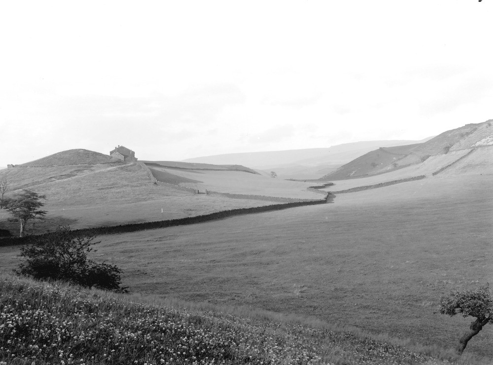
| Caption: | Hollingworth Lake (S. side), about 2 m. S. of Littleborough. Looking E. |
| Description: | Hollingworth Lake (S. side), about 2 m. S. of Littleborough. Looking E. A glacial overflow or 'dry' channel south of Hollingworth Lake, Littleborough. Hill to the left capped by small outlier of flags immediately above Upper Mountain Mine coal (Lower Coal Measures). In the distance Kinderscout Grit escarpment of Blackstone and Walsden Edges. |
| Date taken: | Wed Aug 01 00:00:00 BST 1923 |
| Photographer: | Rhodes, J. |
| Copyright statement: | Crown |
| X longitude/easting: | 393500 |
| Y latitude/northing: | 414500 |
| Coordinate reference system, ESPG code: | 27700 (OSGB 1936 / British National Grid) |
| Orientation: | Landscape |
| Size: | 162.44 KB; 1000 x 739 pixels; 85 x 63 mm (print at 300 DPI); 265 x 196 mm (screen at 96 DPI); |
| Average Rating: | Not yet rated |
| Categories: | Unsorted Images, Geoscience subjects/ Landforms, glaciation/ Overflow and marginal channels |
Loading...
Loading...
Reviews
There is currently no feedback