| P number: | P202491 |
|---|---|
| Old photograph number: | A02543 |
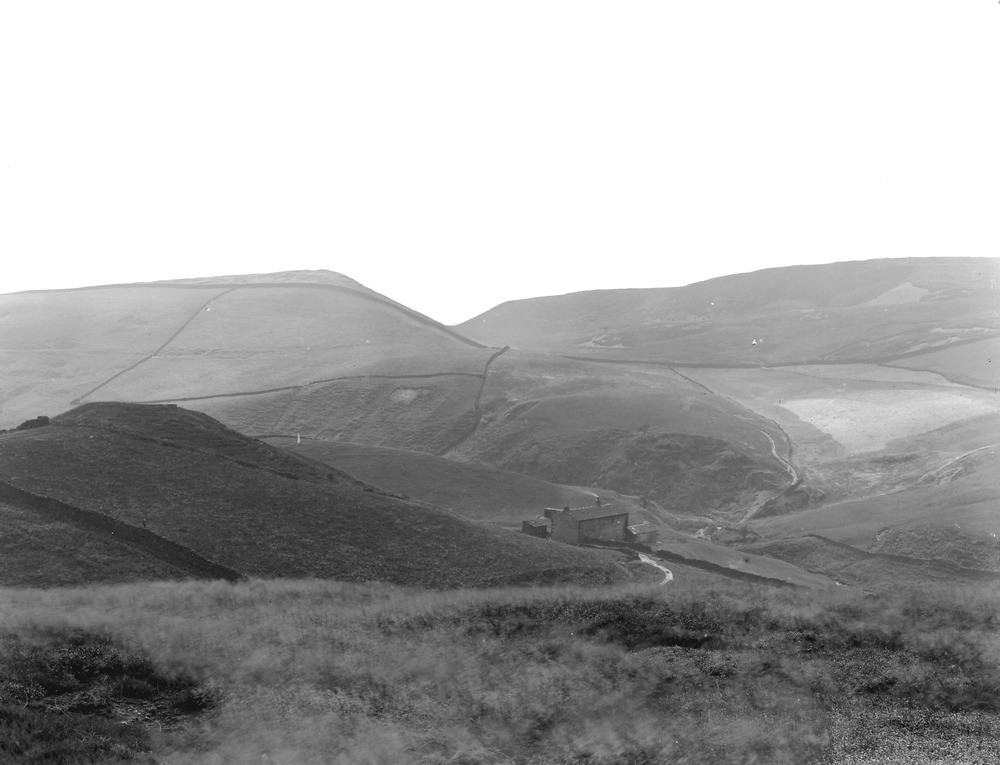
| Caption: | From Caldermoor, about 1/2 m. NNW of Littleborough. Looking W. |
| Description: | From Caldermoor, about 1/2 m. NNW of Littleborough. Looking W. In distance is Ratcliff Hill glacial overflow or 'dry' channel (streamless). Gorge-like valley immediately behind house entirely choked with drift. Rocks much faulted hereabouts. Distant hills consist of Lower Coal Measures; prominent knoll to left of house is a faulted mass of Rough Rock. |
| Date taken: | Wed Aug 01 00:00:00 BST 1923 |
| Photographer: | Rhodes, J. |
| Copyright statement: | Crown |
| X longitude/easting: | 392500 |
| Y latitude/northing: | 416500 |
| Coordinate reference system, ESPG code: | 27700 (OSGB 1936 / British National Grid) |
| Orientation: | Landscape |
| Size: | 136.10 KB; 1000 x 765 pixels; 85 x 65 mm (print at 300 DPI); 265 x 202 mm (screen at 96 DPI); |
| Average Rating: | Not yet rated |
| Categories: | Unsorted Images, Geoscience subjects/ Landforms, glaciation/ Overflow and marginal channels, Geoscience subjects/ Landforms, river/ Gorges and ravines |
Loading...
Loading...
Reviews
There is currently no feedback