| P number: | P202490 |
|---|---|
| Old photograph number: | A02542 |
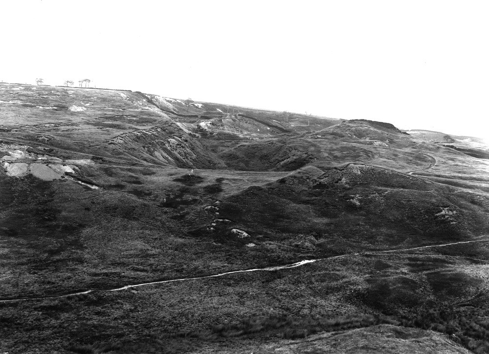
| Caption: | Caldermoor, about 1/2 m. NNW of Littleborough. Looking NNE. |
| Description: | Caldermoor, about 1/2 m. NNW of Littleborough. Looking NNE. Remarkable succession of landslips at Caldermoor near Littleborough. Its desolate appearance due to recent deforestation to obtain pitprops in the war. The slipping masses are Bullion Mine Rock resting on soft shaly mudstones which overlie the Lower Mountain Mine coal (Lower Coal Measures). |
| Date taken: | Wed Aug 01 00:00:00 BST 1923 |
| Photographer: | Rhodes, J. |
| Copyright statement: | Crown |
| X longitude/easting: | 392500 |
| Y latitude/northing: | 416500 |
| Coordinate reference system, ESPG code: | 27700 (OSGB 1936 / British National Grid) |
| Orientation: | Landscape |
| Size: | 233.87 KB; 1000 x 723 pixels; 85 x 61 mm (print at 300 DPI); 265 x 191 mm (screen at 96 DPI); |
| Average Rating: | Not yet rated |
| Categories: | Unsorted Images, Geoscience subjects/ Landforms, weathering/ Landslips |
Loading...
Loading...
Reviews
There is currently no feedback