| P number: | P202478 |
|---|---|
| Old photograph number: | A02530 |
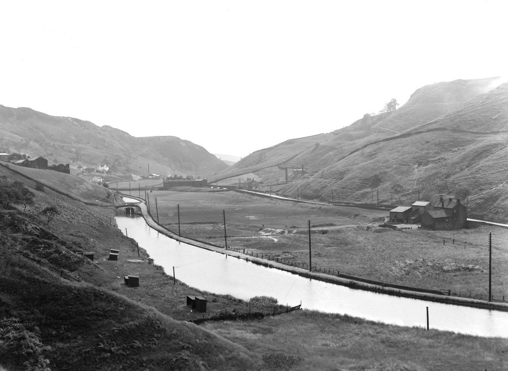
| Caption: | From Warland. Looking S. |
| Description: | From Warland. Looking S. The Summit gorge at Warland. The watershed of the Pennines at this point is cut right across by a steep gorge 300 ft. deep in places. From the houses in the middle distance streams flow respectively into the Irish and North Seas. A canal crosses the watershed here also. The gorge is believed to be largely if not entirely produced by glacial meltwaters. |
| Date taken: | Wed Aug 01 00:00:00 BST 1923 |
| Photographer: | Rhodes, J. |
| Copyright statement: | Crown |
| X longitude/easting: | 394500 |
| Y latitude/northing: | 420500 |
| Coordinate reference system, ESPG code: | 27700 (OSGB 1936 / British National Grid) |
| Orientation: | Landscape |
| Size: | 171.71 KB; 1001 x 731 pixels; 85 x 62 mm (print at 300 DPI); 265 x 193 mm (screen at 96 DPI); |
| Average Rating: | Not yet rated |
| Categories: | Unsorted Images, Geoscience subjects/ Landforms, glaciation/ Overflow and marginal channels |
Loading...
Loading...
Reviews
There is currently no feedback