| P number: | P202414 |
|---|---|
| Old photograph number: | A02466 |
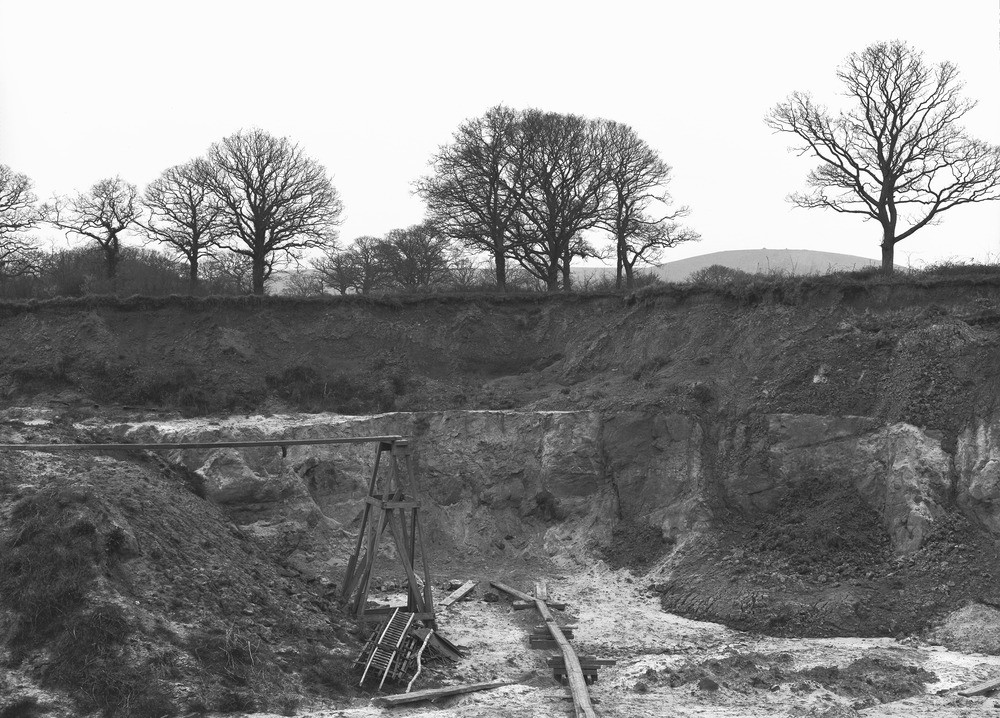
| Caption: | Sand-pit, 1/2 m. W. of Hassocks Station. Looking S. |
| Description: | Sand-pit, 1/2 m. W. of Hassocks Station. Looking S. Junction of Lower Greensand and Gault. Description of No. A2465 applies. [Junction of Lower Greensand and Gault. Current-bedded sands of the Folkestone Beds, overlain by evenly stratified sandy clay with white phosphatic concretions of the Gault. A band of iron-sandstone occurs at the junction. The Gault is capped by 1 or 2 feet of superficial loam with scattered flints and bits of iron-sandstone.] |
| Date taken: | Sun Apr 01 00:00:00 GMT 1923 |
| Photographer: | Rhodes, J. |
| Copyright statement: | Crown |
| X longitude/easting: | 529500 |
| Y latitude/northing: | 115500 |
| Coordinate reference system, ESPG code: | 27700 (OSGB 1936 / British National Grid) |
| Orientation: | Landscape |
| Size: | 284.35 KB; 1000 x 718 pixels; 85 x 61 mm (print at 300 DPI); 265 x 190 mm (screen at 96 DPI); |
| Average Rating: | Not yet rated |
| Categories: | Unsorted Images, Geoscience subjects/ Economic geology/ Gravel and sand |
Loading...
Loading...
Reviews
There is currently no feedback