| P number: | P202405 |
|---|---|
| Old photograph number: | A02457 |
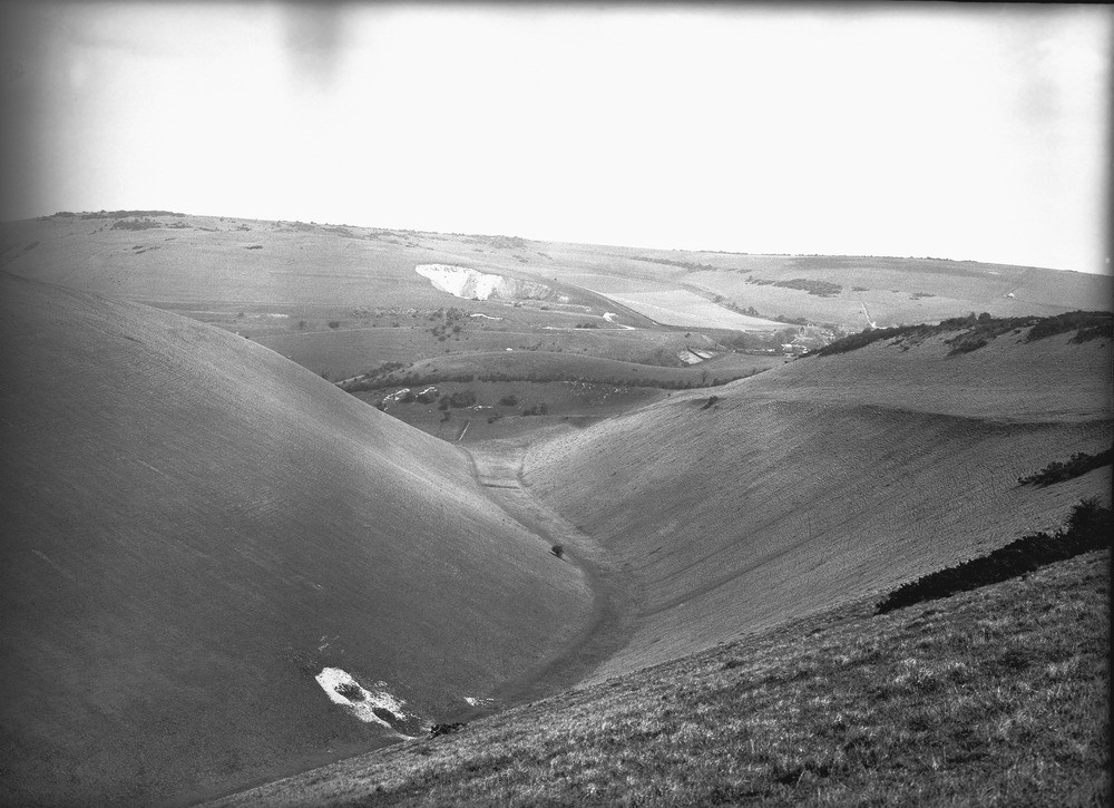
| Caption: | Devil's Dyke, about 1/2 m. S. of Poynings. Looking NE. |
| Description: | Devil's Dyke, about 1/2 m. S. of Poynings. Looking NE. The Devil's Dyke. View near the lower end of the combe, showing part of Saddlecombe hamlet and quarry in Middle Chalk in background, with West Hill beyond. An old cultivation terrace is seen on the side of the Dyke, to the right. |
| Date taken: | Sun Apr 01 00:00:00 GMT 1923 |
| Photographer: | Rhodes, J. |
| Copyright statement: | Crown |
| X longitude/easting: | 526500 |
| Y latitude/northing: | 111500 |
| Coordinate reference system, ESPG code: | 27700 (OSGB 1936 / British National Grid) |
| Orientation: | Landscape |
| Size: | 215.24 KB; 1000 x 725 pixels; 85 x 61 mm (print at 300 DPI); 265 x 192 mm (screen at 96 DPI); |
| Average Rating: | Not yet rated |
| Categories: | Unsorted Images, Geoscience subjects/ General views/ Chalk country |
Loading...
Loading...
Reviews
There is currently no feedback