| P number: | P202404 |
|---|---|
| Old photograph number: | A02456 |
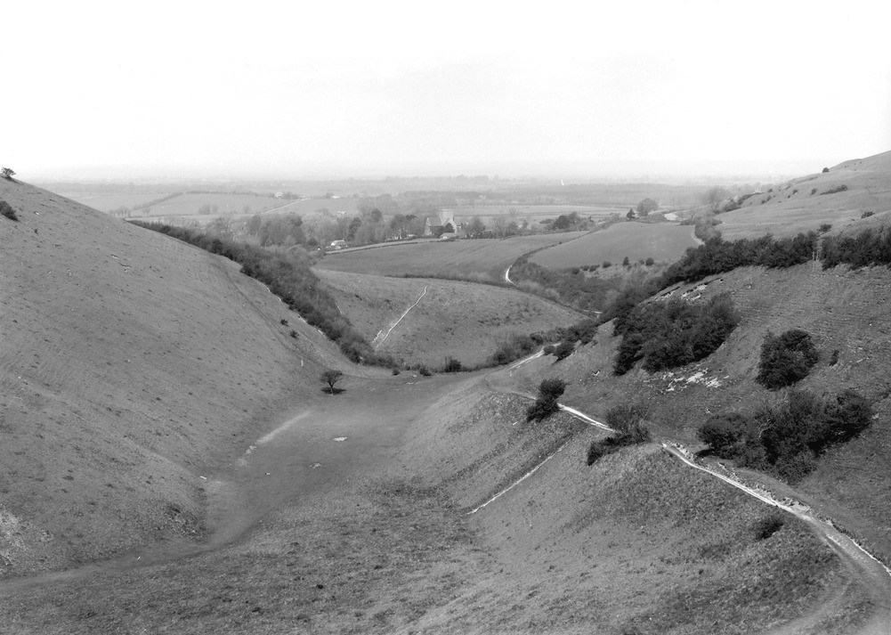
| Caption: | Devil's Dyke, about 1/2 m. S. of Poynings. Looking N. |
| Description: | Devil's Dyke, about 1/2 m. S. of Poynings. Looking N. The Devil's Dyke. A deep combe in the South Downs, opening on the Chalk escarpment above Poynings. The lower end of the combe, here shown, is in the Lower Chalk, which supports Poynings Church, in the middle of the view. Beyond the church, the Poynings Grange ridge (with three white houses on its crest), and the more distant Hurstpierpont ridge, are on outcrops of Lower Greensand respectively south and north of the Pyecombe anticlinal axis. |
| Date taken: | Sun Apr 01 00:00:00 GMT 1923 |
| Photographer: | Rhodes, J. |
| Copyright statement: | Crown |
| X longitude/easting: | 526500 |
| Y latitude/northing: | 111500 |
| Coordinate reference system, ESPG code: | 27700 (OSGB 1936 / British National Grid) |
| Orientation: | Landscape |
| Size: | 196.26 KB; 1001 x 713 pixels; 85 x 60 mm (print at 300 DPI); 265 x 189 mm (screen at 96 DPI); |
| Average Rating: | Not yet rated |
| Categories: | Unsorted Images, Geoscience subjects/ General views/ Chalk country |
Loading...
Loading...
Reviews
There is currently no feedback