| P number: | P202397 |
|---|---|
| Old photograph number: | A02449 |
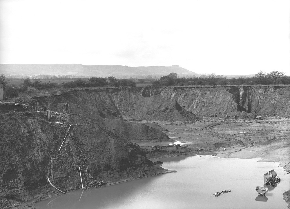
| Caption: | Clay-pit in S. bank of River Adur, 1 m. NNE of Upper Beeding Priory Church. Looking W. |
| Description: | Clay-pit in S. bank of River Adur, 1 m. NNE of Upper Beeding Priory Church. Looking W. Pit in the Gault. In foreground, British Portland Cement Company's pit in fossiliferous marly clay in the upper part of the Lower Gault. The pit is opened in a slight ridge projecting westward into the Adur flood-plain (seen in middle distance) and is dug to below river-level. In the background is the Chalk escarpment of the South Downs, between Steyning Round Hill (on left) and Chanctonbury Ring. |
| Date taken: | Sun Apr 01 00:00:00 GMT 1923 |
| Photographer: | Rhodes, J. |
| Copyright statement: | Crown |
| X longitude/easting: | 520500 |
| Y latitude/northing: | 112500 |
| Coordinate reference system, ESPG code: | 27700 (OSGB 1936 / British National Grid) |
| Orientation: | Landscape |
| Size: | 204.88 KB; 1000 x 722 pixels; 85 x 61 mm (print at 300 DPI); 265 x 191 mm (screen at 96 DPI); |
| Average Rating: | Not yet rated |
| Categories: | Unsorted Images, Geoscience subjects/ Economic geology/ Bricks, clay and marl quarries, Geoscience subjects/ Economic geology/ Cement and lime, limestone quarries and chalk pits |
Loading...
Loading...
Reviews
There is currently no feedback