| P number: | P202394 |
|---|---|
| Old photograph number: | A02446 |
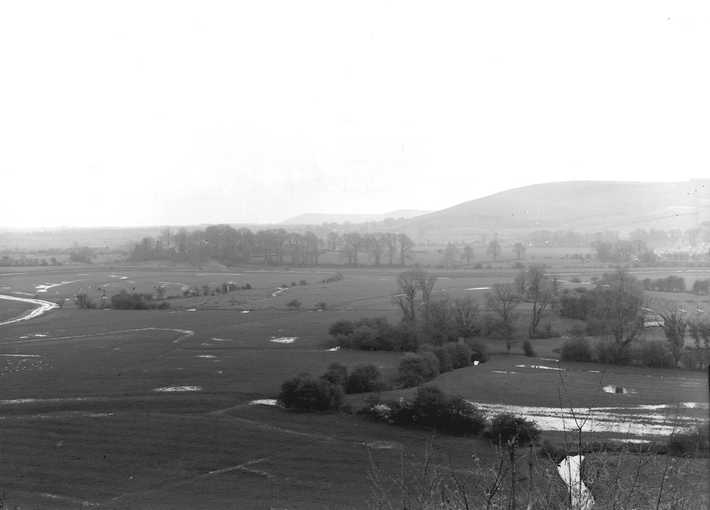
| Caption: | Adur Valley, from Bramber Castle. Looking E. |
| Description: | Adur Valley, from Bramber Castle. Looking E. The Adur Valley near Bramber. Imperfectly drained flood plain of the Adur, on the Selbornian Bed in foreground. The embankment course of the river is discernible in the middle distance. Across the river, near middle of view, a clump of trees surrounds the Church and Priory of Upper Beeding, situated on a low bluff of Upper Greensand. In the background is the Chalk escarpment of the South Downs at Truleigh Hill (on right), Newtimber Hill, and Wolstanbury Hill. |
| Date taken: | Sun Apr 01 00:00:00 GMT 1923 |
| Photographer: | Rhodes, J. |
| Copyright statement: | Crown |
| X longitude/easting: | 518500 |
| Y latitude/northing: | 110500 |
| Coordinate reference system, ESPG code: | 27700 (OSGB 1936 / British National Grid) |
| Orientation: | Landscape |
| Size: | 121.48 KB; 1000 x 719 pixels; 85 x 61 mm (print at 300 DPI); 265 x 190 mm (screen at 96 DPI); |
| Average Rating: | Not yet rated |
| Categories: | Unsorted Images, Geoscience subjects/ Landforms, river/ Flood-plains and alluvial flats |
Loading...
Loading...
Reviews
There is currently no feedback