| P number: | P202386 |
|---|---|
| Old photograph number: | A02438 |
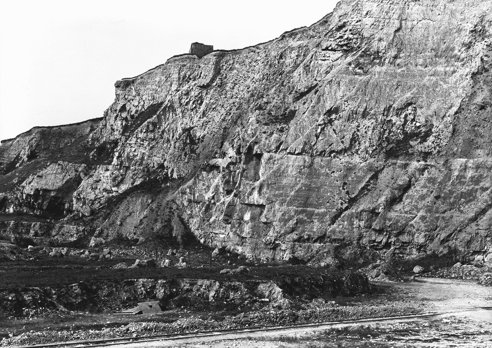
| Caption: | Cement Works Quarry, S. of Lock Barn, about 1 m. S. of Upper Beeding. Looking N. |
| Description: | Cement Works Quarry, S. of Lock Barn, about 1 m. S. of Upper Beeding. Looking N. Section in Middle and Upper Chalk. Firm to hard nodular chalk in the Zones of Terebratulina lata, Holaster planus, and Micraster cortestudinarium. (a.) Marl-seam at upper limit of the Terebratulina lata Zone. (b.) Approximate position of the rock-band at the upper limit of the Holaster planus Zone. |
| Date taken: | Sun Apr 01 00:00:00 GMT 1923 |
| Photographer: | Rhodes, J. |
| Copyright statement: | Crown |
| X longitude/easting: | 520500 |
| Y latitude/northing: | 108500 |
| Coordinate reference system, ESPG code: | 27700 (OSGB 1936 / British National Grid) |
| Orientation: | Landscape |
| Size: | 385.71 KB; 1000 x 707 pixels; 85 x 60 mm (print at 300 DPI); 265 x 187 mm (screen at 96 DPI); |
| Average Rating: | Not yet rated |
| Categories: | Unsorted Images, Geoscience subjects/ Economic geology/ Cement and lime, limestone quarries and chalk pits |
Loading...
Loading...
Reviews
There is currently no feedback