| P number: | P202374 |
|---|---|
| Old photograph number: | A02426 |
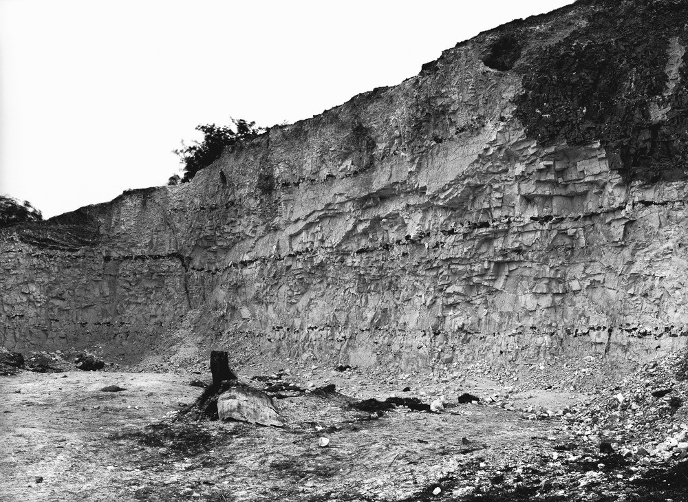
| Caption: | Chalk-pit, N. of Hill Cottages, 3/4 m. N. of Salvington. Looking SSW. |
| Description: | Chalk-pit, N. of Hill Cottages, 3/4 m. N. of Salvington. Looking SSW. Section in Zone of Actinocamax. White, flint-bearing chalk in the lower part of the zone. A small fault is shown in the left-hand half of the view. |
| Date taken: | Sun Apr 01 00:00:00 GMT 1923 |
| Photographer: | Rhodes, J. |
| Copyright statement: | Crown |
| X longitude/easting: | 513500 |
| Y latitude/northing: | 106500 |
| Coordinate reference system, ESPG code: | 27700 (OSGB 1936 / British National Grid) |
| Orientation: | Landscape |
| Size: | 361.47 KB; 1000 x 730 pixels; 85 x 62 mm (print at 300 DPI); 265 x 193 mm (screen at 96 DPI); |
| Average Rating: | Not yet rated |
| Categories: | Unsorted Images, Geoscience subjects/ Economic geology/ Cement and lime, limestone quarries and chalk pits |
Loading...
Loading...
Reviews
There is currently no feedback