| P number: | P202370 |
|---|---|
| Old photograph number: | A02422 |
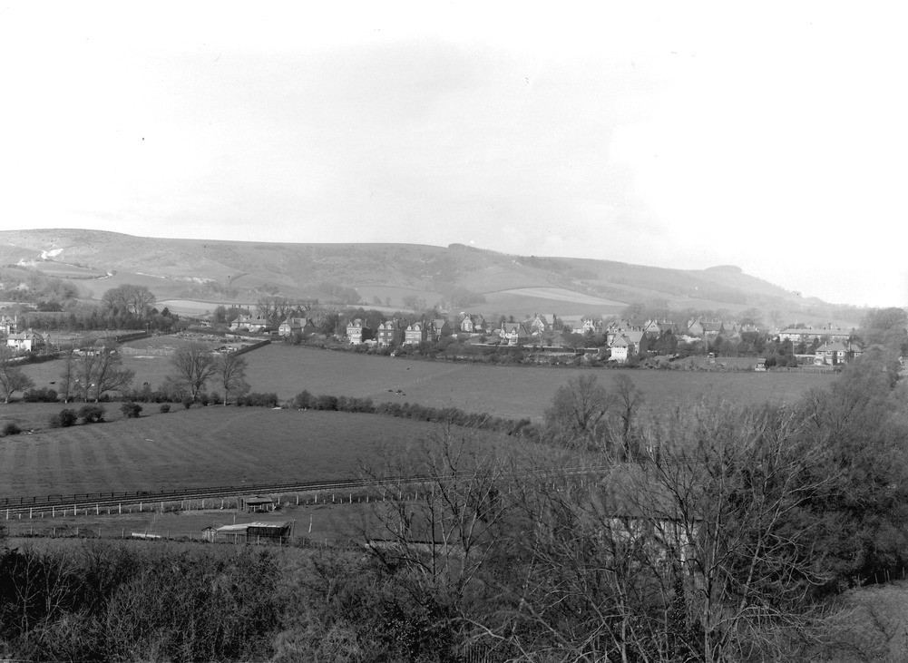
| Caption: | Steyning Round Hill and Chanctonbury Ring from Bramber Castle. Looking WNW. |
| Description: | Steyning Round Hill and Chanctonbury Ring from Bramber Castle. Looking WNW. Steyning. The village stands on the Upper Greensand and the Lower Chalk. The escarpment beyond the village is formed by the Middle Chalk and the lower beds of the Upper Chalk. A road-side pit in Middle Chalk (Terebratulina lata Zone) is seen in the face of Round Hill near the left side of the view, and the tree-clump of Chanctonbury Ring in the distance on the right. |
| Date taken: | Sun Apr 01 00:00:00 GMT 1923 |
| Photographer: | Rhodes, J. |
| Copyright statement: | Crown |
| X longitude/easting: | 518500 |
| Y latitude/northing: | 110500 |
| Coordinate reference system, ESPG code: | 27700 (OSGB 1936 / British National Grid) |
| Orientation: | Landscape |
| Size: | 189.40 KB; 1001 x 731 pixels; 85 x 62 mm (print at 300 DPI); 265 x 193 mm (screen at 96 DPI); |
| Average Rating: | Not yet rated |
| Categories: | Unsorted Images |
Loading...
Loading...
Reviews
There is currently no feedback