| P number: | P202347 |
|---|---|
| Old photograph number: | A02399 |
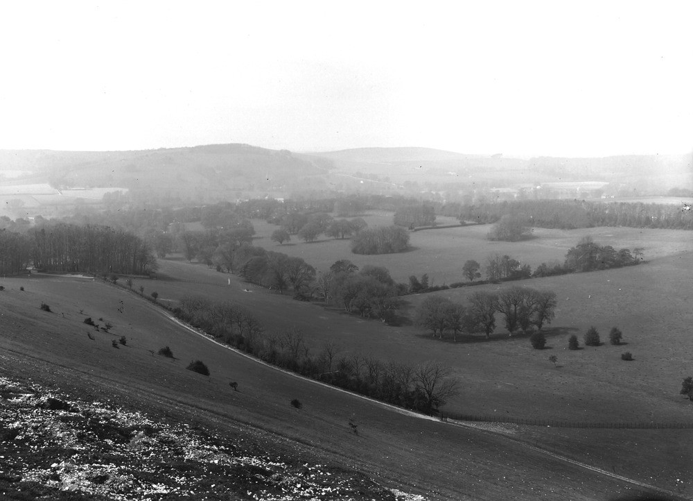
| Caption: | View across Findon Valley, from Cissbury Ring. Looking NW. |
| Description: | View across Findon Valley, from Cissbury Ring. Looking NW. The Second or Outer Chalk escarpment of the South Downs. Cissbury Hill in foreground, Church Hill in background on left and Black Patch Hill in distance near middle of view, are developed on the outcrop of Offaster pilula and Act.quadratus Zones of the Chalk. Their north (right-hand) slopes form part of a discontinuous escarpment which runs through the South Downs westward of the River Adur and dominates the vale opened in the less resistant chalk of the Marsupites Zone. The Findon Valley, following the dip-slope from right to left, is not clearly seen. It passes on the hither side of Church Hill above Findon village. |
| Date taken: | Sun Apr 01 00:00:00 GMT 1923 |
| Photographer: | Rhodes, J. |
| Copyright statement: | Crown |
| X longitude/easting: | 513500 |
| Y latitude/northing: | 108500 |
| Coordinate reference system, ESPG code: | 27700 (OSGB 1936 / British National Grid) |
| Orientation: | Landscape |
| Size: | 154.10 KB; 1000 x 722 pixels; 85 x 61 mm (print at 300 DPI); 265 x 191 mm (screen at 96 DPI); |
| Average Rating: | Not yet rated |
| Categories: | Unsorted Images, Geoscience subjects/ Landforms, river/ Escarpments |
Loading...
Loading...
Reviews
There is currently no feedback