| P number: | P000386 |
|---|---|
| Old photograph number: | C01443 |
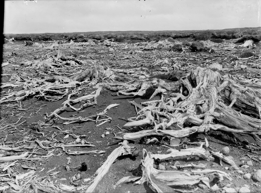
| Caption: | 1.6 km. south-east of Daless, Findhorn Valley. Remains of pine forest on an ancient land surface exposed by natural decay of peat. |
| Description: | 1.6 km. south-east of Daless, Findhorn Valley. Remains of pine forest on an ancient land surface exposed by natural decay of peat. A former dense cover of pine trees is suggested by the abundant pine stumps, roots and broken trunks exposed in deflation hollows such as the one in the photograph. It is thought unlikely, however, that all the trees were coeval. Deflation hollows are small hollows or depressions caused by wind erosion. Removal of the vegetation can lead to greater erosion. |
| Date taken: | Sat Jan 01 00:00:00 GMT 1910 |
| Photographer: | Lunn, R. |
| Copyright statement: | Crown |
| Acknowledgment: | This image was digitized with grant-in-aid from SCRAN the Scottish Cultural Resources Access Network |
| X longitude/easting: | 287500 |
| Y latitude/northing: | 837500 |
| Coordinate reference system, ESPG code: | 27700 (OSGB 1936 / British National Grid) |
| Orientation: | Landscape |
| Size: | 319.39 KB; 1000 x 738 pixels; 85 x 62 mm (print at 300 DPI); 265 x 195 mm (screen at 96 DPI); |
| Average Rating: | Not yet rated |
| Categories: | Best of BGS Images/ Images from the archives, Geoscience subjects/ Stratigraphical |
Loading...
Loading...
Reviews
There is currently no feedback