| P number: | P202247 |
|---|---|
| Old photograph number: | A02299 |
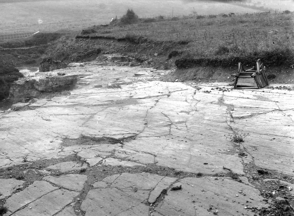
| Caption: | Barf's Quarry, Charity Lane, between Distington and Harrington. Looking E. |
| Description: | Barf's Quarry, Charity Lane, between Distington and Harrington. Looking E. Glaciated pavement on Hensingham Grit. The striae run north-north-east to SSW The Grit is overlain by Boulder Clay. |
| Date taken: | Tue Aug 01 00:00:00 BST 1922 |
| Photographer: | Rhodes, J. |
| Copyright statement: | Crown |
| X longitude/easting: | 300500 |
| Y latitude/northing: | 524500 |
| Coordinate reference system, ESPG code: | 27700 (OSGB 1936 / British National Grid) |
| Orientation: | Landscape |
| Size: | 291.44 KB; 1001 x 736 pixels; 85 x 62 mm (print at 300 DPI); 265 x 195 mm (screen at 96 DPI); |
| Average Rating: | Not yet rated |
| Categories: | Unsorted Images, Geoscience subjects/ Landforms, glaciation/ Glaciated surfaces, Geoscience subjects/ Landforms, glaciation/ Glacial striae |
Loading...
Loading...
Reviews
There is currently no feedback