| P number: | P000375 |
|---|---|
| Old photograph number: | C01410 |
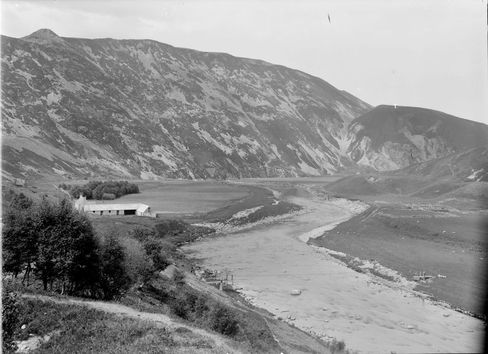
| Caption: | Polochaig, 4.8 km. east of Loch Moy. Inverness-shire. River and glaciofluvial terraces and the main Creag a' Chrocain overflow channel viewed from the vicinity of Shenachie, Findhorn Valley. |
| Description: | Polochaig, 4.8 km. east of Loch Moy. Inverness-shire. River and glaciofluvial terraces and the main Creag a' Chrocain overflow channel viewed from the vicinity of Shenachie, Findhorn Valley. Showing stages in the retreat of the Findhorn glacier. In distance on right - temporary overflow channel cut out of schists and granite. Moraine on skyline on left. Recent alluvial terraces of River Findhorn in foreground. Note the ropeway for use in traversing the river. Shenachie is now marked as a ruin on Ordnance Survey maps. |
| Date taken: | Sat Jan 01 00:00:00 GMT 1910 |
| Photographer: | Lunn, R. |
| Copyright statement: | Crown |
| Acknowledgment: | This image was digitized with grant-in-aid from SCRAN the Scottish Cultural Resources Access Network |
| Orientation: | Landscape |
| Size: | 212.95 KB; 1000 x 727 pixels; 85 x 62 mm (print at 300 DPI); 265 x 192 mm (screen at 96 DPI); |
| Average Rating: | Not yet rated |
| Categories: | Unsorted Images, Geoscience subjects/ Landforms, glaciation/ Overflow and marginal channels |
Loading...
Loading...
Reviews
There is currently no feedback