| P number: | P000374 |
|---|---|
| Old photograph number: | C01391 |
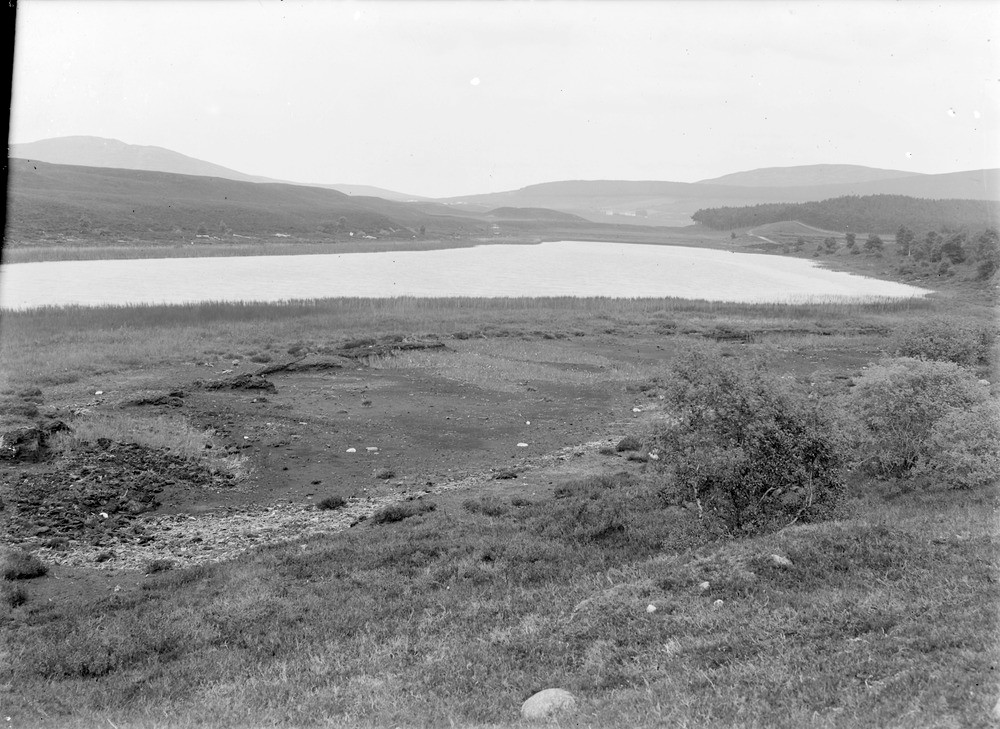
| Caption: | Loch Mor, 7.2 km. west-south-west of Grantown-on-Spey. Loch in 'kettle hole' in glacial gravels, with esker to right. |
| Description: | Loch Mor, 7.2 km. west-south-west of Grantown-on-Spey. Loch in 'kettle hole' in glacial gravels, with esker to right. The kettle hole, a basin- or bowl-shaped hollow in glacial gravels and sometimes filled with water as in Loch Mor, formed as a result of the melting of a large block of stagnant ice that had been left behind by a retreating glacier. The esker, a long narrow ridge, often sinuous and composed of glacial sands and gravels is the remains of a subglacial or englacial stream which was left behind when the ice melted. |
| Date taken: | Sat Jan 01 00:00:00 GMT 1910 |
| Photographer: | Lunn, R. |
| Copyright statement: | Crown |
| Acknowledgment: | This image was digitized with grant-in-aid from SCRAN the Scottish Cultural Resources Access Network |
| X longitude/easting: | 296500 |
| Y latitude/northing: | 825500 |
| Coordinate reference system, ESPG code: | 27700 (OSGB 1936 / British National Grid) |
| Orientation: | Landscape |
| Size: | 221.10 KB; 1000 x 729 pixels; 85 x 62 mm (print at 300 DPI); 265 x 193 mm (screen at 96 DPI); |
| Average Rating: | Not yet rated |
| Categories: | Unsorted Images, Geoscience subjects/ Landforms, glaciation/ Kettle-holes |
Loading...
Loading...
Reviews
There is currently no feedback