| P number: | P000373 |
|---|---|
| Old photograph number: | C01390 |
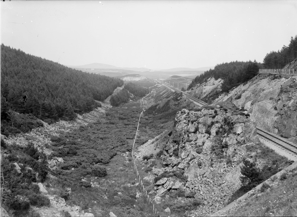
| Caption: | Slochd Beag, 5.6 km. west of Carrbridge. Inverness-shire. Looking east-north-east. A glacial overflow channel. |
| Description: | Slochd Beag, 5.6 km. west of Carrbridge. Inverness-shire. Looking east-north-east. A glacial overflow channel. The channel was eroded by marginal drainage from the Findhorn glacier escaping eastwards onto the ground left bare by the retreat of the Dunlan glacier. The Carrbridge - Inverness railway line is seen on the right of the photograph. |
| Date taken: | Sat Jan 01 00:00:00 GMT 1910 |
| Photographer: | Lunn, R. |
| Copyright statement: | Crown |
| Acknowledgment: | This image was digitized with grant-in-aid from SCRAN the Scottish Cultural Resources Access Network |
| X longitude/easting: | 284500 |
| Y latitude/northing: | 790500 |
| Coordinate reference system, ESPG code: | 27700 (OSGB 1936 / British National Grid) |
| Orientation: | Landscape |
| Size: | 229.61 KB; 1001 x 732 pixels; 85 x 62 mm (print at 300 DPI); 265 x 194 mm (screen at 96 DPI); |
| Average Rating: | Not yet rated |
| Categories: | Unsorted Images |
Loading...
Loading...
Reviews
There is currently no feedback