| P number: | P202151 |
|---|---|
| Old photograph number: | A02202 |
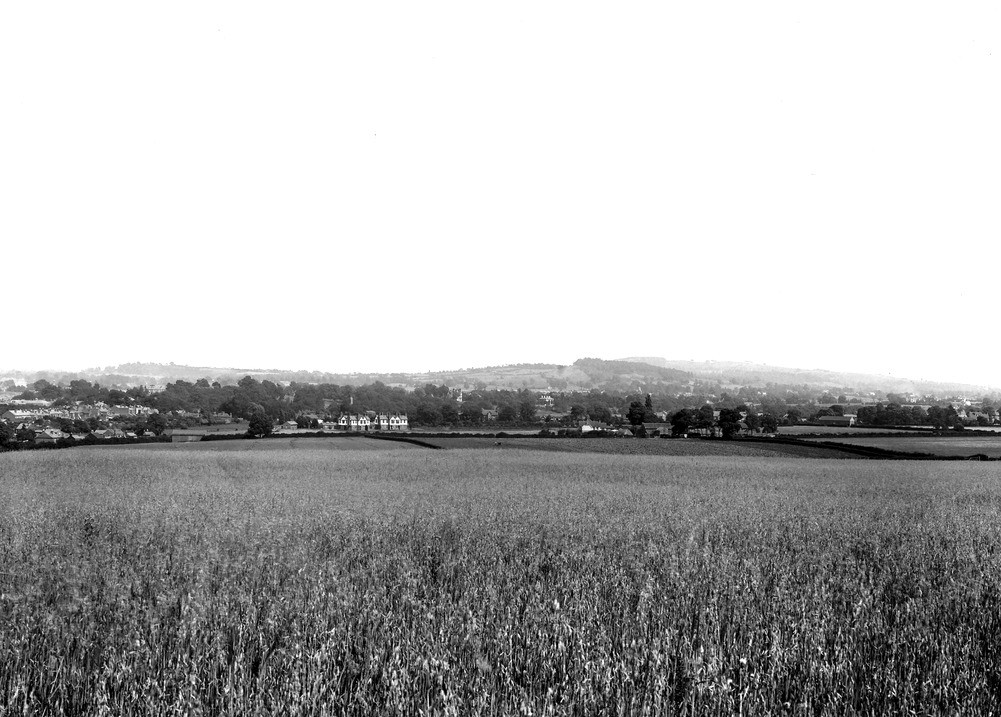
| Caption: | Wychbury Hill, from near the cemetery, Stourbridge. Looking E. |
| Description: | Wychbury Hill, from near the cemetery, Stourbridge. Looking E. General view of Hodge Hill, Wychbury Hill and Clent Hill. Hodge Hill (left, in distance): Halesowen Sandstone. Wychbury Hill (right centre): Clent Breccia, with Keuper Sandstone faulted against it. Clent Hill (right distance): Clent Breccia. The tree-covered ridge in the middle distance is the outcrop of the Lower Keuper Sandstone, the escarpment of which faces the camera. |
| Date taken: | Sat Jul 01 00:00:00 BST 1922 |
| Photographer: | Rhodes, J. |
| Copyright statement: | Crown |
| X longitude/easting: | 392500 |
| Y latitude/northing: | 281500 |
| Coordinate reference system, ESPG code: | 27700 (OSGB 1936 / British National Grid) |
| Orientation: | Landscape |
| Size: | 196.86 KB; 1001 x 717 pixels; 85 x 61 mm (print at 300 DPI); 265 x 190 mm (screen at 96 DPI); |
| Average Rating: | Not yet rated |
| Categories: | Unsorted Images, Geoscience subjects/ General views/ Sand, sandstone and grit country |
Loading...
Loading...
Reviews
There is currently no feedback