| P number: | P000363 |
|---|---|
| Old photograph number: | C01368 |
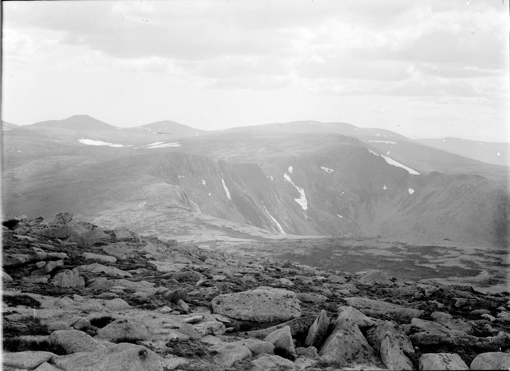
| Caption: | From near the top of Cairngorm. Looking west. Inverness-shire. The plateau surface showing granite weathering out into blocks and disintegrating in situ on mountain top forming a blockfield. The Braeriach plateau in the distance. |
| Description: | From near the top of Cairngorm. Looking west. Inverness-shire. The plateau surface showing granite weathering out into blocks and disintegrating in situ on mountain top forming a blockfield. The Braeriach plateau in the distance. The blockfield is formed by 'periglacial' processes where frost and ground ice shatter the granite bedrock. The Cairngorm summits form the highest of a series of stepped erosion surfaces which are found across north-east Scotland. They date from the Tertiary period before the glaciers. Periglacial landforms are those formed by cold-climate non-glacial processes. |
| Date taken: | Sat Jan 01 00:00:00 GMT 1910 |
| Photographer: | Lunn, R. |
| Copyright statement: | Crown |
| Acknowledgment: | This image was digitized with grant-in-aid from SCRAN the Scottish Cultural Resources Access Network |
| X longitude/easting: | 300500 |
| Y latitude/northing: | 804500 |
| Coordinate reference system, ESPG code: | 27700 (OSGB 1936 / British National Grid) |
| Orientation: | Landscape |
| Size: | 178.11 KB; 1000 x 728 pixels; 85 x 62 mm (print at 300 DPI); 265 x 193 mm (screen at 96 DPI); |
| Average Rating: | Not yet rated |
| Categories: | Unsorted Images, Geoscience subjects/ Landforms, weathering/ Rock weathering, Geoscience subjects/ Landforms, weathering/ Plateaux |
Loading...
Loading...
Reviews
There is currently no feedback