| P number: | P000359 |
|---|---|
| Old photograph number: | C01359 |
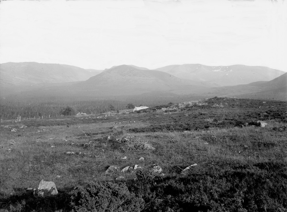
| Caption: | Carn Eilrig from Rothiemurchus Forest. Inverness-shire. Creag an Leth-choin (Lurcher's Crag) and Cairngorm are on left, separated from these by Lurcher's Gully is Braeriach, on the right, in distance. |
| Description: | Carn Eilrig from Rothiemurchus Forest. Inverness-shire. Creag an Leth-choin (Lurcher's Crag) and Cairngorm are on left, separated from these by Lurcher's Gully is Braeriach, on the right, in distance. All the hills are formed of a large granite batholith emplaced at a depth of 4-6 km. at c. 408 Ma. The Cairngorm summits form the highest of a series of stepped erosion surfaces which are found across north-east Scotland. They date from the Tertiary period before the glaciers. One theory on the origin of the surfaces is that they formed by marine erosion. |
| Date taken: | Sat Jan 01 00:00:00 GMT 1910 |
| Photographer: | Lunn, R. |
| Copyright statement: | Crown |
| Acknowledgment: | This image was digitized with grant-in-aid from SCRAN the Scottish Cultural Resources Access Network |
| X longitude/easting: | 293500 |
| Y latitude/northing: | 805500 |
| Coordinate reference system, ESPG code: | 27700 (OSGB 1936 / British National Grid) |
| Orientation: | Landscape |
| Size: | 188.38 KB; 1000 x 737 pixels; 85 x 62 mm (print at 300 DPI); 265 x 195 mm (screen at 96 DPI); |
| Average Rating: | Not yet rated |
| Categories: | Unsorted Images |
Loading...
Loading...
Reviews
There is currently no feedback