| P number: | P000356 |
|---|---|
| Old photograph number: | C01348 |
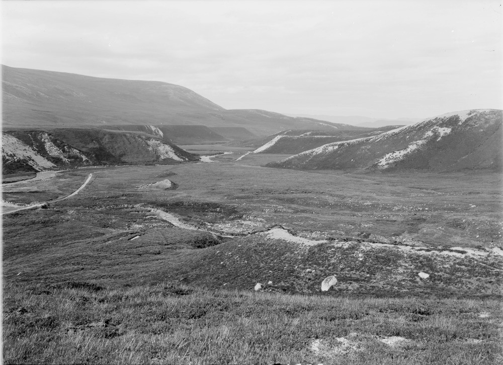
| Caption: | Gleann Einich, 9.7 km. south-south-east of Aviemore. Inverness-shire. Deltaic fluvioglacial terraces of sand and gravel isolated and denuded by subsequent stream action. |
| Description: | Gleann Einich, 9.7 km. south-south-east of Aviemore. Inverness-shire. Deltaic fluvioglacial terraces of sand and gravel isolated and denuded by subsequent stream action. The evidence from the disposition and type of fluvioglacial deposits indicates that they were formed by deltaic deposits laid down by the drainage from the hillsides and high-level corrie glaciers into a glacial lake being held up by the Einich glacier, interpreted as an outlet lobe of an invasive ice sheet spilling over the Moine Mhor. The overall picture in the area was one where the high northern slopes of the Cairngorms were mostly free of ice, apart from the high corrie hanging glaciers. The great hollow of Glen More was filled with an ice mass, tongues of which protruded into the lower parts of Gleann Einich and the Lairig Ghru forming a dam behind which a glacial lake formed. |
| Date taken: | Sat Jan 01 00:00:00 GMT 1910 |
| Photographer: | Lunn, R. |
| Copyright statement: | Crown |
| Acknowledgment: | This image was digitized with grant-in-aid from SCRAN the Scottish Cultural Resources Access Network |
| X longitude/easting: | 292500 |
| Y latitude/northing: | 803500 |
| Coordinate reference system, ESPG code: | 27700 (OSGB 1936 / British National Grid) |
| Orientation: | Landscape |
| Size: | 219.75 KB; 1000 x 725 pixels; 85 x 61 mm (print at 300 DPI); 265 x 192 mm (screen at 96 DPI); |
| Average Rating: | Not yet rated |
| Categories: | Unsorted Images, Geoscience subjects/ Landforms, river/ River terraces and cliffs |
Loading...
Loading...
Reviews
There is currently no feedback