| P number: | P000339 |
|---|---|
| Old photograph number: | B00893 |
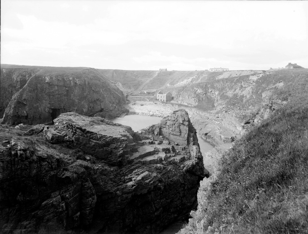
| Caption: | Sarclet Haven, 7.242 km. south of Wick. Cliffs of the Old Red Sandstone Sarclet Sandstone Formation with a back-wall of shelly boulder clay deposited during the last glaciation. A ruined building is seen just above high water mark. |
| Description: | Sarclet Haven, 7.242 km. south of Wick. Cliffs of the Old Red Sandstone Sarclet Sandstone Formation with a back-wall of shelly boulder clay deposited during the last glaciation. A ruined building is seen just above high water mark. The uninterrupted profile in the background shows that the hollow is part of a pre-glacial trough formerly filled with boulder clay but now excavated by the sea. The rocks in this area are extensively fractured probably due to the convergence of the Helmsdale, Great Glen and Wick fault systems immediately offshore. |
| Date taken: | Mon Jan 01 00:00:00 GMT 1912 |
| Photographer: | Lunn, R. |
| Copyright statement: | Crown |
| Acknowledgment: | This image was digitized with grant-in-aid from SCRAN the Scottish Cultural Resources Access Network |
| X longitude/easting: | 335200 |
| Y latitude/northing: | 943300 |
| Coordinate reference system, ESPG code: | 27700 (OSGB 1936 / British National Grid) |
| Orientation: | Landscape |
| Size: | 207.46 KB; 1000 x 758 pixels; 85 x 64 mm (print at 300 DPI); 265 x 201 mm (screen at 96 DPI); |
| Average Rating: | Not yet rated |
| Categories: | Unsorted Images |
Loading...
Loading...
Reviews
There is currently no feedback