| P number: | P000338 |
|---|---|
| Old photograph number: | B00890 |
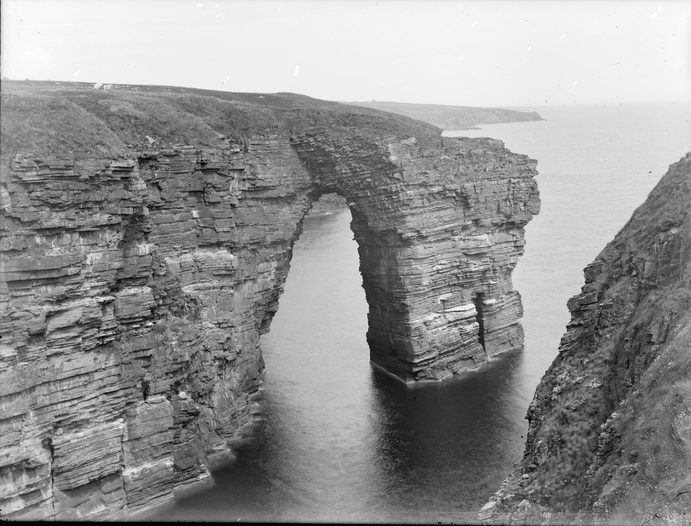
| Caption: | The Needle' from the south side of Ashy Geo, 5.633 km. south of Wick. Caithness. |
| Description: | The natural arch has been formed by the wave action concentrated on the sides of the headland and exploiting lines of weakness caused by the well-jointed rocks. Note the joints in the foreground on the left and the stepped formation at the base of the cliff leading to the arch. Eventually the roof of the arch will collapse to form a free-standing sea stack. A sea cliff with a natural arch eroded in purple and green mudstones. Red Sandstone beds form the bridge of the arch and the upper part of the cliff. The rocks are of Old Red Sandstone age. |
| Date taken: | Mon Jan 01 00:00:00 GMT 1912 |
| Photographer: | Lunn, R. |
| Copyright statement: | Crown |
| Acknowledgment: | This image was digitized with grant-in-aid from SCRAN the Scottish Cultural Resources Access Network |
| X longitude/easting: | 335800 |
| Y latitude/northing: | 945000 |
| Coordinate reference system, ESPG code: | 27700 (OSGB 1936 / British National Grid) |
| Orientation: | Landscape |
| Size: | 231.28 KB; 1000 x 762 pixels; 85 x 65 mm (print at 300 DPI); 265 x 202 mm (screen at 96 DPI); |
| Average Rating: | Not yet rated |
| Categories: | Unsorted Images, Geoscience subjects/ Landforms, marine/ Natural arches |
Loading...
Loading...
Reviews
There is currently no feedback