| P number: | P201814 |
|---|---|
| Old photograph number: | A01863 |
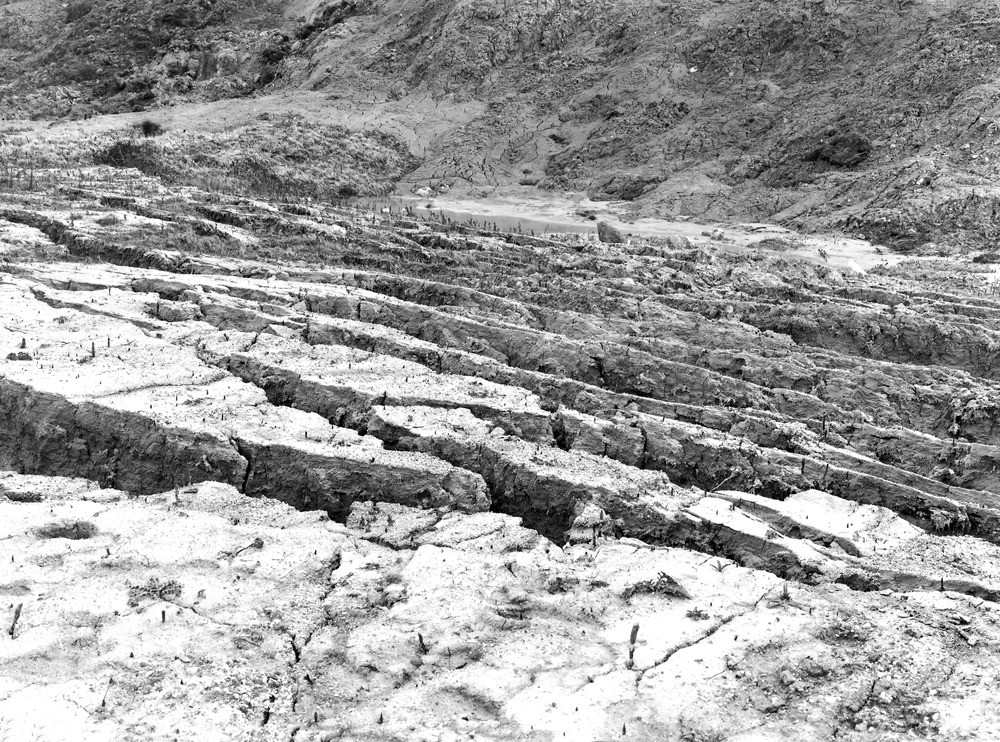
| Caption: | On N. side of Headon Hill, Totland Bay. Looking E. |
| Description: | On N. side of Headon Hill, Totland Bay. Looking E. Mud-flow, Headon Hill. Fissured crust of mud-flow from slipped clays of the Headon Beds. The water in background is that of a pond in the hollow of a landslip. The fissures are due to a renewal of the slipping in the Lower Headon Beds. |
| Date taken: | Tue Mar 01 00:00:00 GMT 1921 |
| Photographer: | Rhodes, J. |
| Copyright statement: | Crown |
| X longitude/easting: | 431500 |
| Y latitude/northing: | 86500 |
| Coordinate reference system, ESPG code: | 27700 (OSGB 1936 / British National Grid) |
| Orientation: | Landscape |
| Size: | 412.96 KB; 1000 x 742 pixels; 85 x 63 mm (print at 300 DPI); 265 x 196 mm (screen at 96 DPI); |
| Average Rating: | Not yet rated |
| Categories: | Unsorted Images, Geoscience subjects/ Landforms, weathering/ Landslips, Geoscience subjects/ Landforms, marine/ Coastal landslips |
Loading...
Loading...
Reviews
There is currently no feedback