| P number: | P201787 |
|---|---|
| Old photograph number: | A01836 |
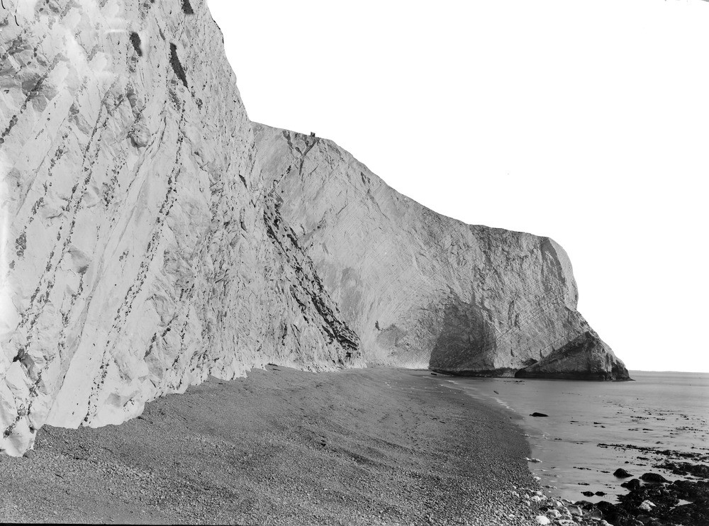
| Caption: | General View of E. end of Scratchell's Bay, and the Grand Arch. Looking E. |
| Description: | General View of E. end of Scratchell's Bay, and the Grand Arch. Looking E. Eastern end of Scratchell's Bay, and Grand Arch. Cliff in Upper Chalk about 300 ft. high at the Arch. The promontory in shadow on right is in Zone of Micraster cortestudinarium. The Grand Arch is worn in the Zone of Micraster coranguinum, and the Chalk to the left of it belongs to the succeeding Zones of Marsupites, Offaster pilula, and Actinocamax quadratus. Ref: 'A short account of the geology of the Isle of Wight', pp.76, 78, 80, 82, 84. |
| Date taken: | Tue Mar 01 00:00:00 GMT 1921 |
| Photographer: | Rhodes, J. |
| Copyright statement: | Crown |
| X longitude/easting: | 429500 |
| Y latitude/northing: | 84500 |
| Coordinate reference system, ESPG code: | 27700 (OSGB 1936 / British National Grid) |
| Orientation: | Landscape |
| Size: | 239.93 KB; 1000 x 742 pixels; 85 x 63 mm (print at 300 DPI); 265 x 196 mm (screen at 96 DPI); |
| Average Rating: | Not yet rated |
| Categories: | Unsorted Images, Geoscience subjects/ Landforms, marine/ Cliffs, Geoscience subjects/ Landforms, marine/ Coast scenery, general views, Geoscience subjects/ Economic geology/ Cement and lime, limestone quarries and chalk pits |
Loading...
Loading...
Reviews
There is currently no feedback