| P number: | P201749 |
|---|---|
| Old photograph number: | A01798 |
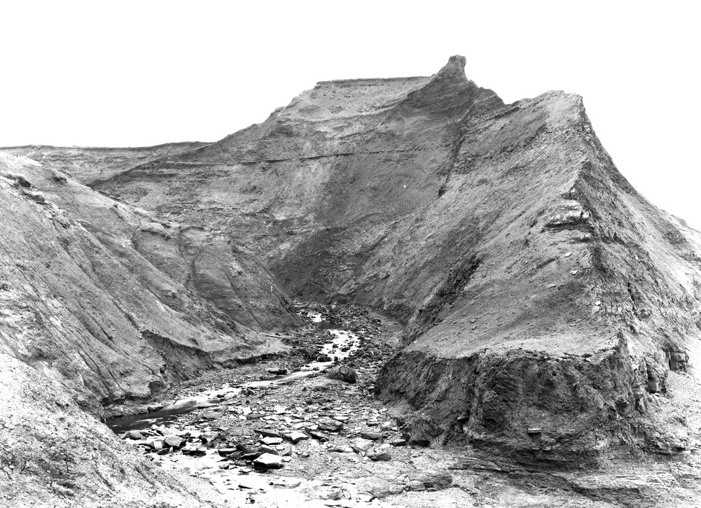
| Caption: | Entrance to Shepherd's Chine, Brightstones Bay, (from foreshore). Looking SE. |
| Description: | Entrance to Shepherd's Chine, Brightstones Bay, (from foreshore). Looking SE. Mouth of Shepherd's Chine. Shepherd's Chine, dating from about the second decade of the XIX Century, when the brook that previously flowed into Cowleaze Chine was artificially diverted to the coast at the spot in view, is excavated in the upper beds of the Wealden Shales, and the lowest beds of the Atherfield Clay. This photograph shows only the Wealden Shales, capped by a few feet of gravelly loam (alluvium) in the tabular feature and dark pinnacle at the top of cliff. Ref: 'A short account of the geology of the Isle of Wight', pp.12, 14, 17, 190. |
| Date taken: | Fri Mar 25 00:00:00 GMT 1921 |
| Photographer: | Rhodes, J. |
| Copyright statement: | Crown |
| X longitude/easting: | 444500 |
| Y latitude/northing: | 79500 |
| Coordinate reference system, ESPG code: | 27700 (OSGB 1936 / British National Grid) |
| Orientation: | Landscape |
| Size: | 314.89 KB; 1001 x 726 pixels; 85 x 61 mm (print at 300 DPI); 265 x 192 mm (screen at 96 DPI); |
| Average Rating: | Not yet rated |
| Categories: | Unsorted Images, Geoscience subjects/ Landforms, river/ River capture and diverted drainage |
Loading...
Loading...
Reviews
There is currently no feedback