| P number: | P201735 |
|---|---|
| Old photograph number: | A01784 |
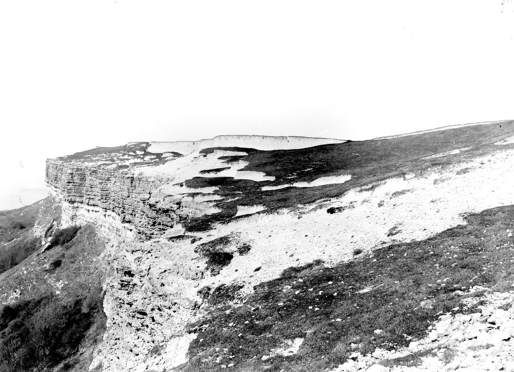
| Caption: | Gore Cliff (summit) about 2 m. SW of Niton. Looking NW. |
| Description: | Gore Cliff (summit) about 2 m. SW of Niton. Looking NW. Summit of Gore Cliff (a). The cliff is in Upper Greensand, of which the Freestone Beds (just above talus, on left) and overlying Chert Beds, are seen. The partly-turfed slope above the cliff is in wind-worn Chloritic Marl and Chalk Marl of the Lower Chalk. The white bluff (about 10 ft. high) in background, consists of fossiliferous, chalky rain-wash, of Recent age. Atherfield Point, and Brxton Bay beyond it, in distance. Ref: 'A short account of the geology of the Isle of Wight', pp.55, 64, 194. |
| Date taken: | Thu Mar 10 00:00:00 GMT 1921 |
| Photographer: | Rhodes, J. |
| Copyright statement: | Crown |
| X longitude/easting: | 449500 |
| Y latitude/northing: | 75500 |
| Coordinate reference system, ESPG code: | 27700 (OSGB 1936 / British National Grid) |
| Orientation: | Landscape |
| Size: | 260.60 KB; 1001 x 724 pixels; 85 x 61 mm (print at 300 DPI); 265 x 192 mm (screen at 96 DPI); |
| Average Rating: | Not yet rated |
| Categories: | Unsorted Images, Geoscience subjects/ Stratigraphical |
Loading...
Loading...
Reviews
There is currently no feedback