| P number: | P201732 |
|---|---|
| Old photograph number: | A01781 |
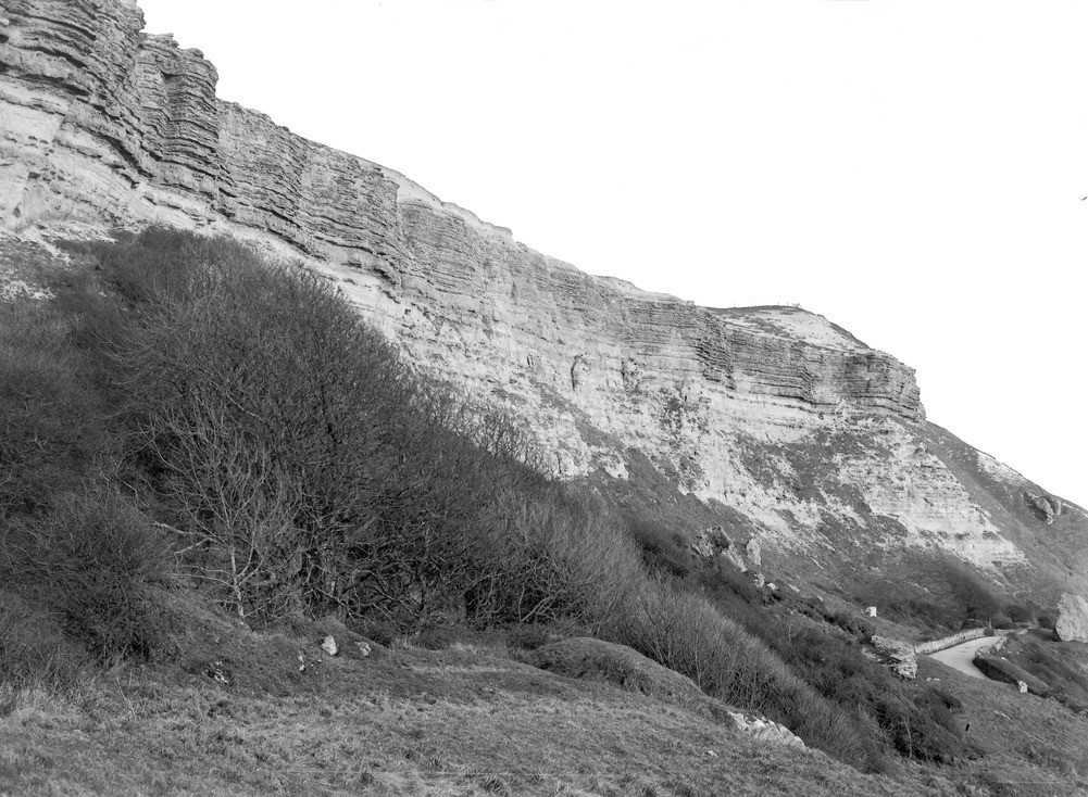
| Caption: | The Undercliff between Niton and Blackgang. Looking S. |
| Description: | The Undercliff between Niton and Blackgang. Looking S. Upper Greensand at Gore Cliff (a). The Chert Beds (22 ft.) in upper part of cliff, slightly overhanging the Freestone Beds (6-8 ft.) just below them. The lower two-thirds of cliff in the sandstone with concretions. A knoll of Lower Chalk above the cliff on the right. Slipped and fallen rock on Gault in foreground. Ref: 'A short account of the geology of the Isle of Wight', pp.55, 64, 196. |
| Date taken: | Thu Feb 24 00:00:00 GMT 1921 |
| Photographer: | Rhodes, J. |
| Copyright statement: | Crown |
| X longitude/easting: | 449500 |
| Y latitude/northing: | 76500 |
| Coordinate reference system, ESPG code: | 27700 (OSGB 1936 / British National Grid) |
| Orientation: | Landscape |
| Size: | 257.64 KB; 1001 x 734 pixels; 85 x 62 mm (print at 300 DPI); 265 x 194 mm (screen at 96 DPI); |
| Average Rating: | Not yet rated |
| Categories: | Unsorted Images, Geoscience subjects/ Stratigraphical |
Loading...
Loading...
Reviews
There is currently no feedback