| P number: | P201659 |
|---|---|
| Old photograph number: | A01708 |
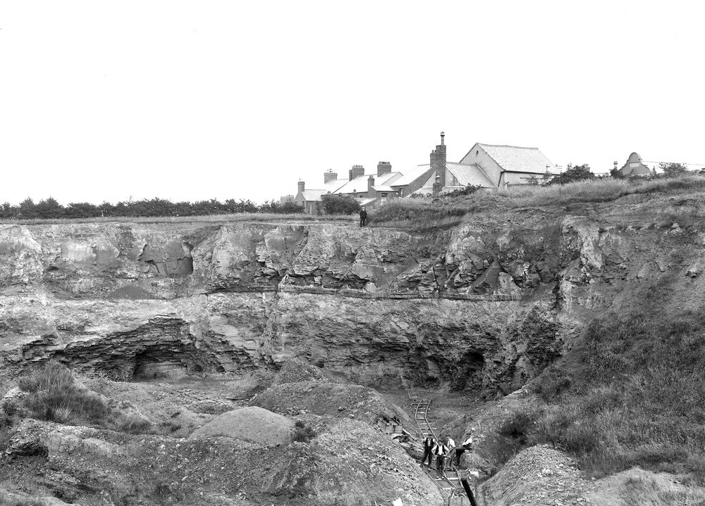
| Caption: | Sandycroft Brick Pit, Buckley. Looking NE. |
| Description: | Sandycroft Brick Pit, Buckley. Looking NE. Brick-pit 800yds east-south-east of St. Matthews Church, Buckley, and on the north side of Drury Lane. The view shows the lower part of the Hollin Rock overlying a thin coal and its underclay, with about 15ft of blue shale below, which includes a horizon full of plant remains. The underclay of the coal and the shale are worked for brick-making. The Bind and Hollin Coals lie a few feet below. (Middle Coal Measures.) |
| Date taken: | Wed Jul 01 00:00:00 GMT 1914 |
| Photographer: | Rhodes, J. |
| Copyright statement: | Crown |
| X longitude/easting: | 327500 |
| Y latitude/northing: | 365500 |
| Coordinate reference system, ESPG code: | 27700 (OSGB 1936 / British National Grid) |
| Orientation: | Landscape |
| Size: | 259.50 KB; 1000 x 719 pixels; 85 x 61 mm (print at 300 DPI); 265 x 190 mm (screen at 96 DPI); |
| Average Rating: | Not yet rated |
| Categories: | Unsorted Images, Geoscience subjects/ Economic geology/ Bricks, clay and marl quarries |
Loading...
Loading...
Reviews
There is currently no feedback