| P number: | P201657 |
|---|---|
| Old photograph number: | A01706 |
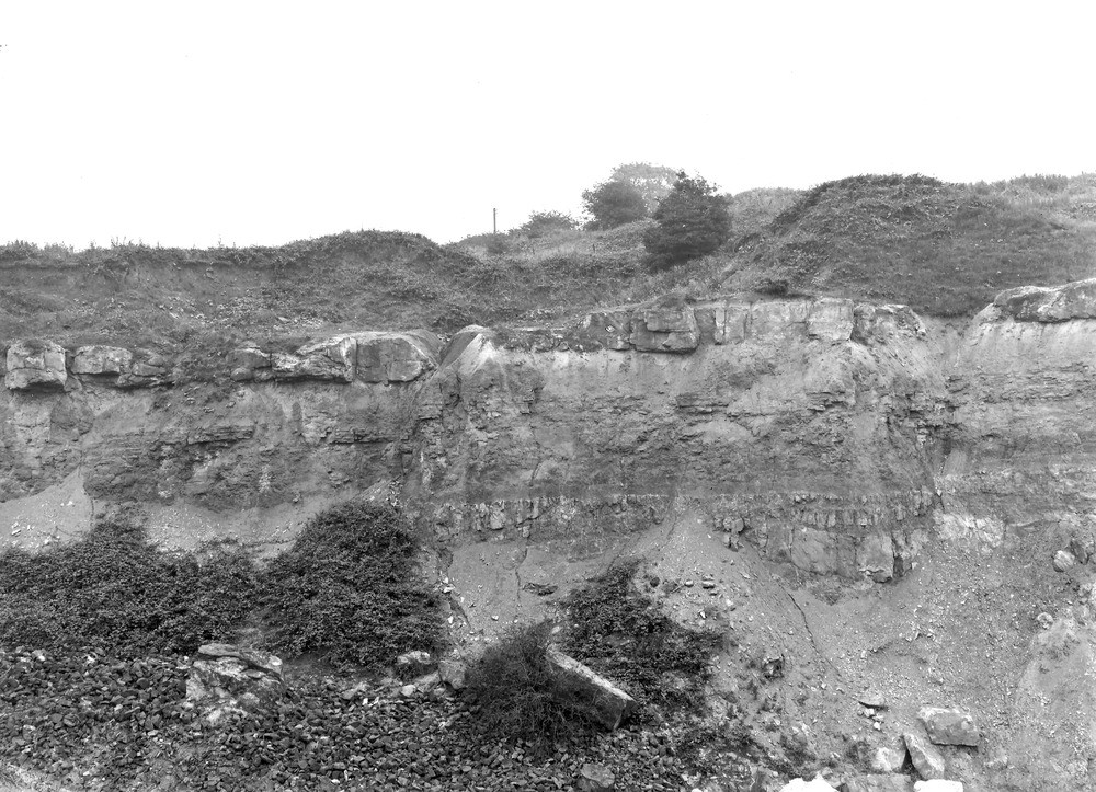
| Caption: | Castle Brick-pit, 300 yd. N. of shafts of Elm Colliery. Looking E. |
| Description: | Castle Brick-pit, 300 yd. N. of shafts of Elm Colliery. Looking E. View of east side of pit showing the sandstone above the Buckley Fireclay, in the following descending order. Thin bed of hard quartzite sandstone. Softer bands of pale green shaly marl and marly and platy sandstone. A conspicuous band of purple shaly marl. Variable beds of sandstone and purple marl. A fault with easterly downthrow runs along the foot of this quarry face, and a small offshoot from it with westerly downthrow, is seen near the right-hand or south side of the photograph. (Buckley Fireclay Group, at top of Middle Coal Measures.) |
| Date taken: | Wed Jul 01 00:00:00 GMT 1914 |
| Photographer: | Rhodes, J. |
| Copyright statement: | Crown |
| X longitude/easting: | 328500 |
| Y latitude/northing: | 366500 |
| Coordinate reference system, ESPG code: | 27700 (OSGB 1936 / British National Grid) |
| Orientation: | Landscape |
| Size: | 273.87 KB; 1000 x 723 pixels; 85 x 61 mm (print at 300 DPI); 265 x 191 mm (screen at 96 DPI); |
| Average Rating: | Not yet rated |
| Categories: | Unsorted Images, Geoscience subjects/ Economic geology/ Bricks, clay and marl quarries |
Loading...
Loading...
Reviews
There is currently no feedback