| P number: | P201654 |
|---|---|
| Old photograph number: | A01703 |
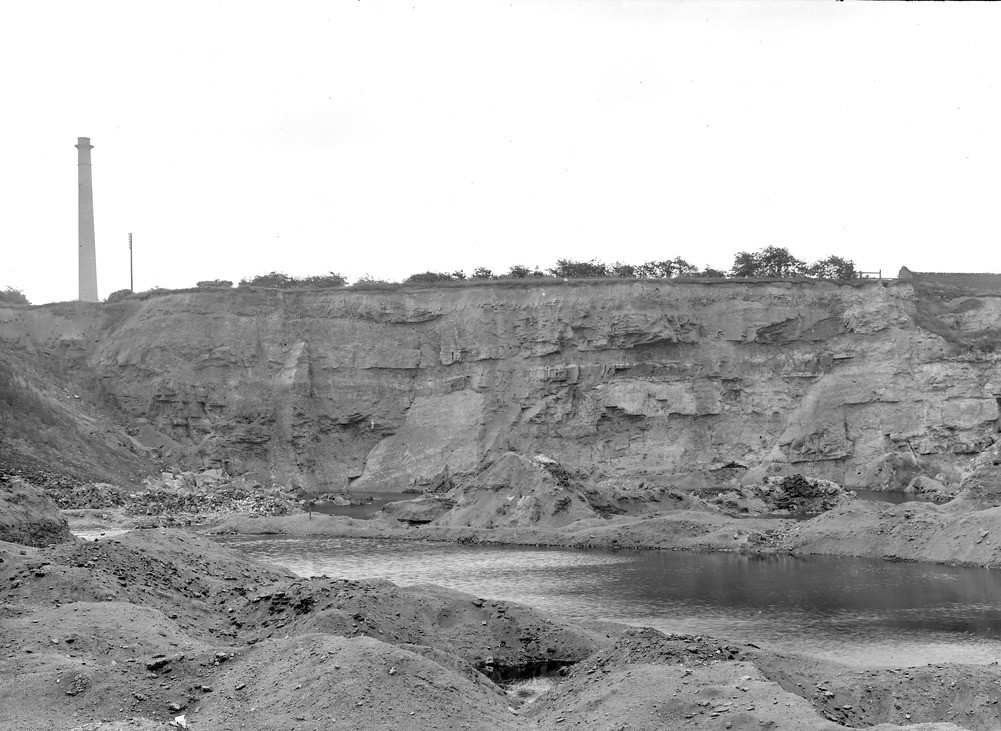
| Caption: | The large Knowl Lane Brick Pit, Buckley, S. end. Looking ESE. |
| Description: | The large Knowl Lane Brick Pit, Buckley, S. end. Looking ESE. The view shows the south wall trending roughly WSW-ENE and containing approximately 50ft of the whitish and reddish sandstone and quartzite (including beds of purple marl or fireclay) and overlying the workable fireclay. The fireclay worked below the sandstone consists, in descending order, of hard white, and softer purple marl, passing down into soft blue shaly marl, down to a thin underlying coal seam; fragments of which, and of ironstone are near in the refuse-heaps in the foreground. The sandstone forms the broad ridge upon which the gravel-hillock of Knowl Hill stands, outside the photograph on the right-hand side. (Buckley Fireclay Group, at top of Middle Coal Measures.) |
| Date taken: | Wed Jul 01 00:00:00 GMT 1914 |
| Photographer: | Rhodes, J. |
| Copyright statement: | Crown |
| X longitude/easting: | 328500 |
| Y latitude/northing: | 364500 |
| Coordinate reference system, ESPG code: | 27700 (OSGB 1936 / British National Grid) |
| Orientation: | Landscape |
| Size: | 220.55 KB; 1001 x 731 pixels; 85 x 62 mm (print at 300 DPI); 265 x 193 mm (screen at 96 DPI); |
| Average Rating: | Not yet rated |
| Categories: | Unsorted Images, Geoscience subjects/ Stratigraphical, Geoscience subjects/ Economic geology/ Bricks, clay and marl quarries |
Loading...
Loading...
Reviews
There is currently no feedback