| P number: | P201653 |
|---|---|
| Old photograph number: | A01702 |
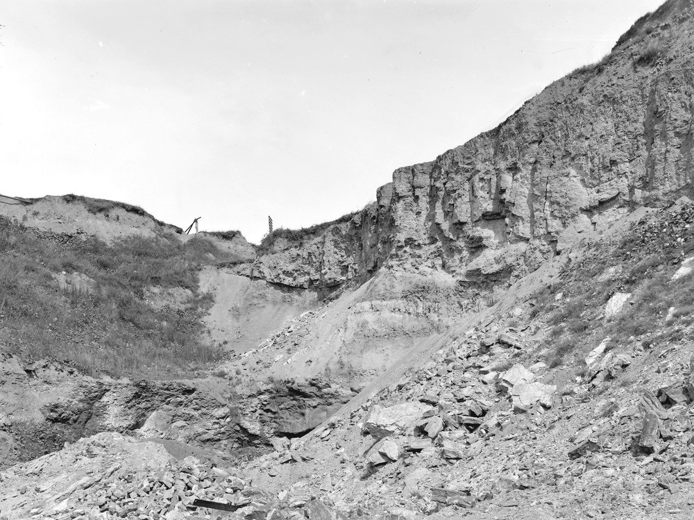
| Caption: | Lane End Brick Pit, Buckley. Looking NW. |
| Description: | Lane End Brick Pit, Buckley. Looking NW. The view shows the lower part of the quartzite sandstone, overlying the Buckley Fireclay. Dip east about 10 degrees. The fireclay below the sandstone consists of white and purple marl passing down irregularly into soft blue shale. A conspicuous band of white marl in the purple is bent up and truncated by the sandstone. This does not indicate any unconformity, but a slight horizontal differential movement, resulting in a little 'thrust', in the process of deformation of the strata. The position of this section is just below the nearest part of the iron fence on the right-hand side of the photograph of Knowl Hill. (Buckley Fireclay Group, at top of Middle Coal Measures.) |
| Date taken: | Wed Jul 01 00:00:00 GMT 1914 |
| Photographer: | Rhodes, J. |
| Copyright statement: | Crown |
| X longitude/easting: | 328500 |
| Y latitude/northing: | 364500 |
| Coordinate reference system, ESPG code: | 27700 (OSGB 1936 / British National Grid) |
| Orientation: | Landscape |
| Size: | 298.64 KB; 1000 x 749 pixels; 85 x 63 mm (print at 300 DPI); 265 x 198 mm (screen at 96 DPI); |
| Average Rating: | Not yet rated |
| Categories: | Unsorted Images, Geoscience subjects/ Stratigraphical, Geoscience subjects/ Economic geology/ Bricks, clay and marl quarries |
Loading...
Loading...
Reviews
There is currently no feedback