| P number: | P201651 |
|---|---|
| Old photograph number: | A01700 |
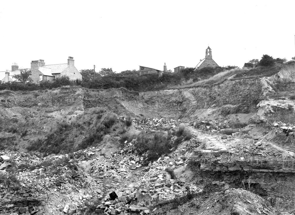
| Caption: | Flint Brick Pit, (Jones's). about 1/2 m. SW of Flint Station. Looking E. |
| Description: | Flint Brick Pit, (Jones's). about 1/2 m. SW of Flint Station. Looking E. View of Brickpit in bank between the Halkin and North Rd. The upper and the greater part of the section shows purple mottled marls. The hard rib under the tramway consists of ironstone-bands associated with purple and yellow-stained, and grey shales. (Upper Coal Measures.) |
| Date taken: | Wed Jul 01 00:00:00 GMT 1914 |
| Photographer: | Rhodes, J. |
| Copyright statement: | Crown |
| X longitude/easting: | 324500 |
| Y latitude/northing: | 372500 |
| Coordinate reference system, ESPG code: | 27700 (OSGB 1936 / British National Grid) |
| Orientation: | Landscape |
| Size: | 291.44 KB; 1000 x 730 pixels; 85 x 62 mm (print at 300 DPI); 265 x 193 mm (screen at 96 DPI); |
| Average Rating: | Not yet rated |
| Categories: | Unsorted Images, Geoscience subjects/ Economic geology/ Bricks, clay and marl quarries |
Loading...
Loading...
Reviews
There is currently no feedback