| P number: | P201509 |
|---|---|
| Old photograph number: | A01521 |
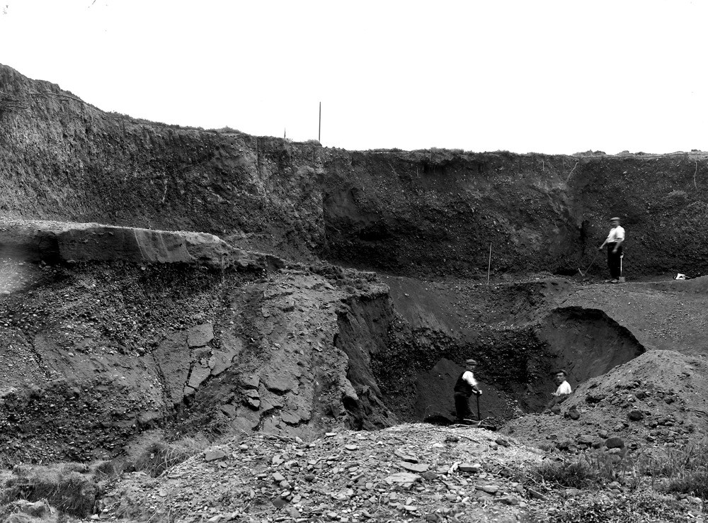
| Caption: | Lichfield Road, W. of Hopwas. Looking SW. |
| Description: | Lichfield Road, W. of Hopwas. Looking SW. The upper part of the photograph shows a large pocket of drift (pebble often vertical) in a hollow in the Bunter Pebble Beds. At the surface it weathers to a mass of pebbles and forms a soil exactly like that of the conglomerate. In this area the pitting is often preserved in the pebbles in the drift. The lower part shows a bed of horizontal Bunter Sandstone resting on a wedge of gravel, with a much higher dip due to current (false) bedding. |
| Date taken: | Sun Oct 13 00:00:00 GMT 1912 |
| Photographer: | Rhodes, J. |
| Copyright statement: | Crown |
| X longitude/easting: | 417500 |
| Y latitude/northing: | 305500 |
| Coordinate reference system, ESPG code: | 27700 (OSGB 1936 / British National Grid) |
| Orientation: | Landscape |
| Size: | 306.29 KB; 1000 x 738 pixels; 85 x 62 mm (print at 300 DPI); 265 x 195 mm (screen at 96 DPI); |
| Average Rating: | Not yet rated |
| Categories: | Unsorted Images, Geoscience subjects/ Landforms, glaciation/ Glacial deposits, boulder clay, sand, gravel, Geoscience subjects/ Economic geology/ Gravel and sand |
Loading...
Loading...
Reviews
There is currently no feedback