| P number: | P000294 |
|---|---|
| Old photograph number: | B00796 |
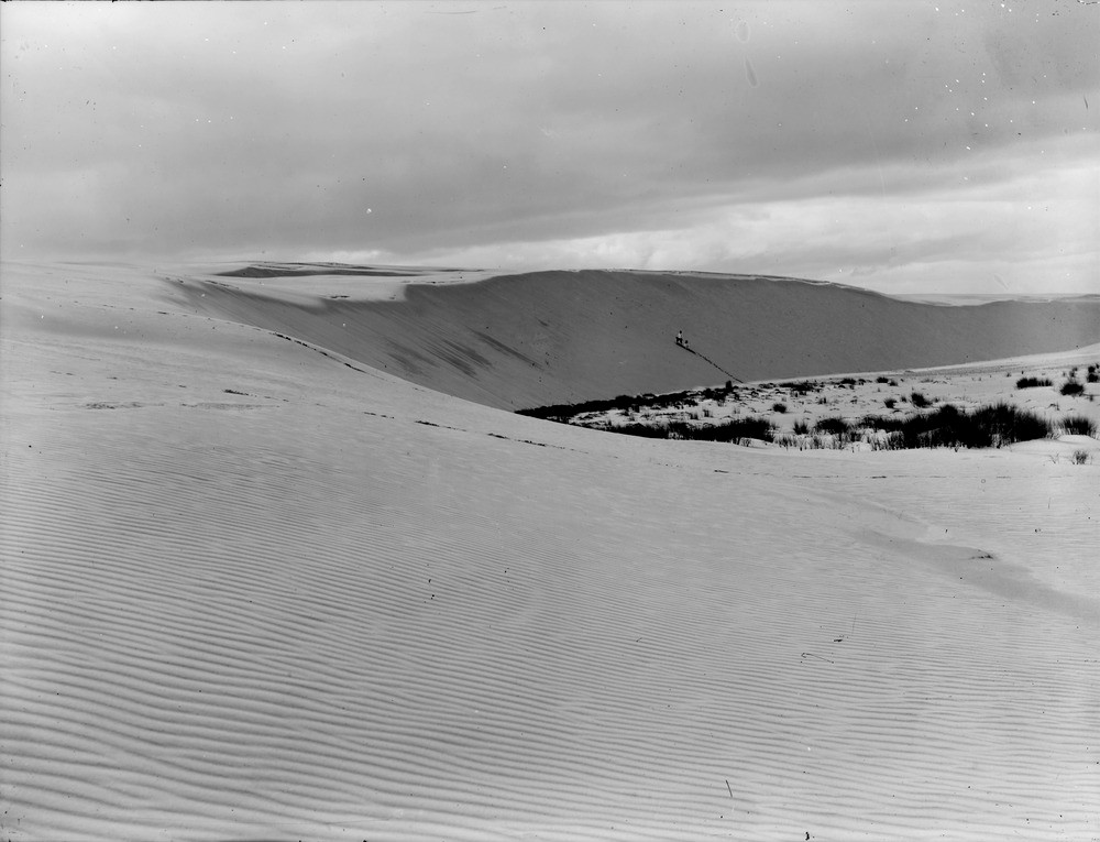
| Caption: | Culbin sand-hills. Morayshire. |
| Description: | On right centre is the old land surface swept clear of advancing sand. The steep bank with cornice atop and the wind-ripples in the foreground indicates that the sand-drift is almost towards observer, i.e. from west to east. Note the curved shape to the dune reminiscent of the crescentic-shaped barchans found in deserts worldwide. The steep concave slope is on the leeward side. The two people on the dune indicate the scale. Only one farm escaped the destruction wrought by the 1694 storm that destroyed most of the Culbin Estate, Earnhill half a mile north of Moy House rests on the 25 foot raised beach. |
| Date taken: | Mon Jan 01 00:00:00 GMT 1912 |
| Photographer: | Lunn, R. |
| Copyright statement: | Crown |
| Acknowledgment: | This image was digitized with grant-in-aid from SCRAN the Scottish Cultural Resources Access Network |
| X longitude/easting: | 298500 |
| Y latitude/northing: | 861500 |
| Coordinate reference system, ESPG code: | 27700 (OSGB 1936 / British National Grid) |
| Orientation: | Landscape |
| Size: | 141.43 KB; 1000 x 765 pixels; 85 x 65 mm (print at 300 DPI); 265 x 202 mm (screen at 96 DPI); |
| Average Rating: | Not yet rated |
| Categories: | Unsorted Images, Geoscience subjects/ Landforms, wind/ Sand-dunes, Geoscience subjects/ Landforms, wind/ Wind ripples |
Loading...
Loading...
Reviews
There is currently no feedback