| P number: | P000293 |
|---|---|
| Old photograph number: | B00795 |
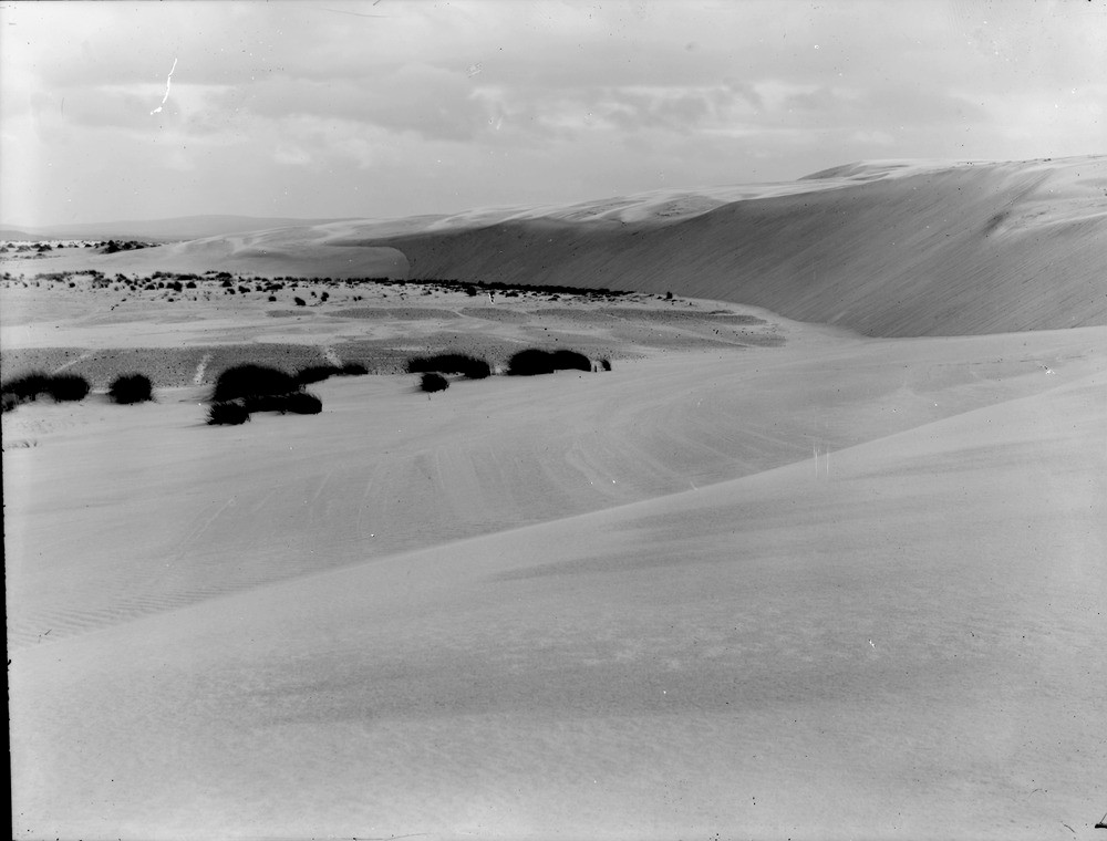
| Caption: | Culbin sand-hills. Morayshire. In centre is the old land surface swept clear of advancing sand and showing ridges and furrows of former cultivation. The sand-drift is from right to left due to the prevailing winds, i.e. from west to east. |
| Description: | Culbin sand-hills. Morayshire. In centre is the old land surface swept clear of advancing sand and showing ridges and furrows of former cultivation. The sand-drift is from right to left due to the prevailing winds, i.e. from west to east. The former Culbin Estate was catastrophically covered by sand in a single great storm in the autumn of 1694. These old ploughed 'rigs' are evidence of former cultivation on the fertile estuarine soils. Records show that the area was very fertile and part of the Culbin Estate. The Barony of Culbin, owned by a family of Kinnairds was said to have comprised 16 farms covering 1456 hectares (though there is some doubt about these figures). |
| Date taken: | Mon Jan 01 00:00:00 GMT 1912 |
| Photographer: | Lunn, R. |
| Copyright statement: | Crown |
| Acknowledgment: | This image was digitized with grant-in-aid from SCRAN the Scottish Cultural Resources Access Network |
| X longitude/easting: | 298500 |
| Y latitude/northing: | 861500 |
| Coordinate reference system, ESPG code: | 27700 (OSGB 1936 / British National Grid) |
| Orientation: | Landscape |
| Size: | 125.10 KB; 1000 x 760 pixels; 85 x 64 mm (print at 300 DPI); 265 x 201 mm (screen at 96 DPI); |
| Average Rating: | Not yet rated |
| Categories: | Unsorted Images |
Loading...
Loading...
Reviews
There is currently no feedback