| P number: | P201356 |
|---|---|
| Old photograph number: | A01368 |
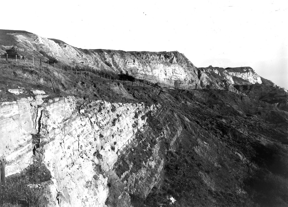
| Caption: | White Nothe, from landslip about 200 yd. SW of Holworth House. Looking ESE. |
| Description: | White Nothe, from landslip about 200 yd. SW of Holworth House. Looking ESE. The skyline is formed by a cliff of Chalk and Upper Greensand, with large landslips over the Gault. To the left under the house the Gault rests with a conspicuous unconformity upon up-turned Portland Stone, Portland Sand and Kimmeridge Clay. The junction of the Gault (dark) and the Portland Stone (white) is clear. The undercliff below is known as Burning Cliff, a bituminous band in the Kimmeridge Clay having been on fire there many years ago. |
| Date taken: | Wed Oct 25 00:00:00 GMT 1911 |
| Photographer: | Rhodes, J. |
| Copyright statement: | Crown |
| X longitude/easting: | 376500 |
| Y latitude/northing: | 81500 |
| Coordinate reference system, ESPG code: | 27700 (OSGB 1936 / British National Grid) |
| Orientation: | Landscape |
| Size: | 270.65 KB; 1000 x 721 pixels; 85 x 61 mm (print at 300 DPI); 265 x 191 mm (screen at 96 DPI); |
| Average Rating: | Not yet rated |
| Categories: | Unsorted Images, Geoscience subjects/ Stratigraphical, Geoscience subjects/ Landforms, marine/ Coastal landslips |
Loading...
Loading...
Reviews
There is currently no feedback