| P number: | P201328 |
|---|---|
| Old photograph number: | A01339 |
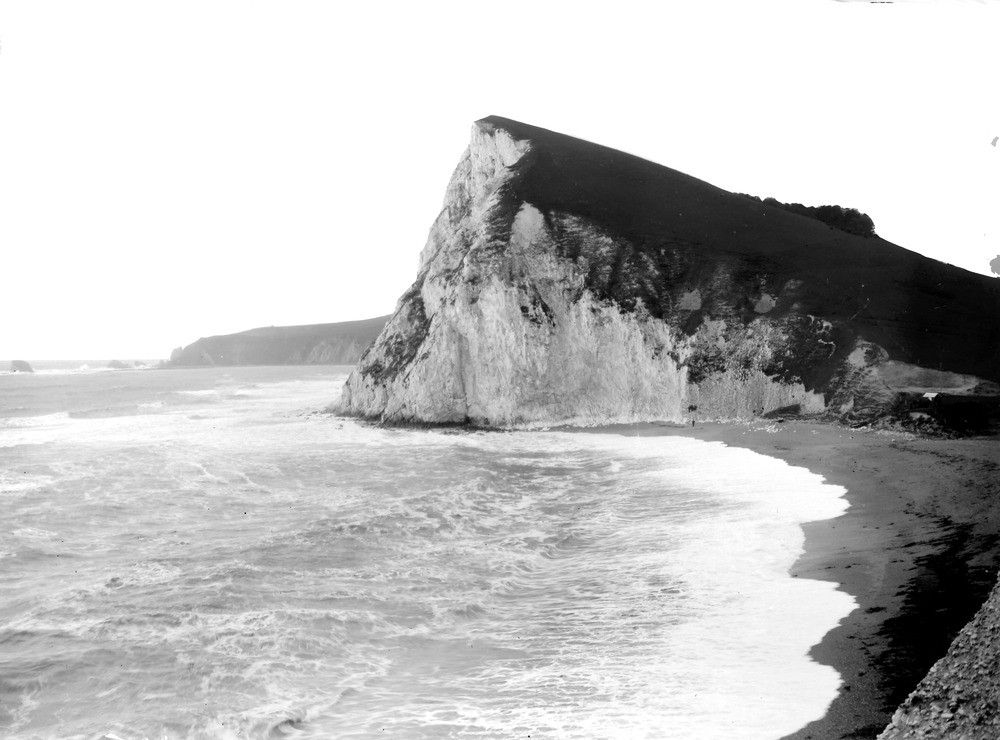
| Caption: | View of W. side of Arish Mell, from cliff above Cover Hole. Looking WSW. |
| Description: | View of W. side of Arish Mell, from cliff above Cover Hole. Looking WSW. Upper Chalk, near vertical. In the distance Mupe Rocks (See No. A1338), formed by Portland Stone (extreme left) and Purbeck Beds. Part of the Wealden Beds of Mupe Bay are visible. |
| Date taken: | Sun Oct 22 00:00:00 GMT 1911 |
| Photographer: | Rhodes, J. |
| Copyright statement: | Crown |
| X longitude/easting: | 384500 |
| Y latitude/northing: | 80500 |
| Coordinate reference system, ESPG code: | 27700 (OSGB 1936 / British National Grid) |
| Orientation: | Landscape |
| Size: | 153.61 KB; 1000 x 740 pixels; 85 x 63 mm (print at 300 DPI); 265 x 196 mm (screen at 96 DPI); |
| Average Rating: | Not yet rated |
| Categories: | Unsorted Images, Geoscience subjects/ Landforms, marine/ Coastal scenery, general views, Geoscience subjects/ Landforms, marine/ Headlands and islands |
Loading...
Loading...
Reviews
There is currently no feedback