| P number: | P000283 |
|---|---|
| Old photograph number: | B00653 |
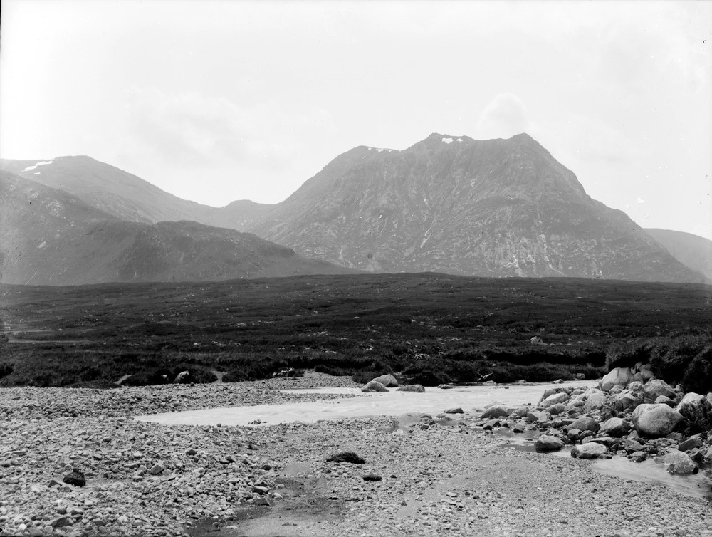
| Caption: | View towards Cam Ghleann, near Kingshouse. Looking south. Argyllshire. Sron na Creise (889.77 m.) on right, consists of Lower Old Red Sandstone agglomerates and rhyolites, resting on Moine gneiss. |
| Description: | View towards Cam Ghleann, near Kingshouse. Looking south. Argyllshire. Sron na Creise (889.77 m.) on right, consists of Lower Old Red Sandstone agglomerates and rhyolites, resting on Moine gneiss. Meall a' Bhuiridh (1108.25 m.) on the left consists of volcanic rocks, and 'Fault Intrusion'. The Moor of Rannoch granite of the Argyll Suite of the Caledonian igneous rocks in the foreground is dated at 408 Ma. Meall a' Bhuiridh = hill of the roaring. |
| Date taken: | Wed Jan 01 00:00:00 GMT 1896 |
| Photographer: | Lunn, R. |
| Copyright statement: | Crown |
| Acknowledgment: | This image was digitized with grant-in-aid from SCRAN the Scottish Cultural Resources Access Network |
| X longitude/easting: | 225900 |
| Y latitude/northing: | 754600 |
| Coordinate reference system, ESPG code: | 27700 (OSGB 1936 / British National Grid) |
| Orientation: | Landscape |
| Size: | 199.58 KB; 1000 x 754 pixels; 85 x 64 mm (print at 300 DPI); 265 x 199 mm (screen at 96 DPI); |
| Average Rating: | Not yet rated |
| Categories: | Unsorted Images |
Loading...
Loading...
Reviews
There is currently no feedback