| P number: | P201282 |
|---|---|
| Old photograph number: | A01293 |
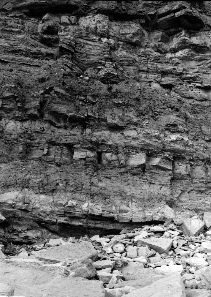
| Caption: | 1/2 m. SW of Peveril Point, Coastguard Station, Durlston Bay. Looking WNW. |
| Description: | 1/2 m. SW of Peveril Point, Coastguard Station, Durlston Bay. Looking WNW. Lowest part of the Middle Purbeck, showing, at the base, the 'Mammal Bed'. (See Geology of the Isle of Purbeck, p. 94.) |
| Date taken: | Thu Oct 12 00:00:00 GMT 1911 |
| Photographer: | Rhodes, J. |
| Copyright statement: | Crown |
| X longitude/easting: | 403500 |
| Y latitude/northing: | 78500 |
| Coordinate reference system, ESPG code: | 27700 (OSGB 1936 / British National Grid) |
| Orientation: | Portrait |
| Size: | 291.65 KB; 712 x 1000 pixels; 60 x 85 mm (print at 300 DPI); 188 x 265 mm (screen at 96 DPI); |
| Average Rating: | Not yet rated |
| Categories: | Unsorted Images, Geoscience subjects/ Stratigraphical |
Loading...
Loading...
Reviews
There is currently no feedback