| P number: | P000275 |
|---|---|
| Old photograph number: | B00640 |
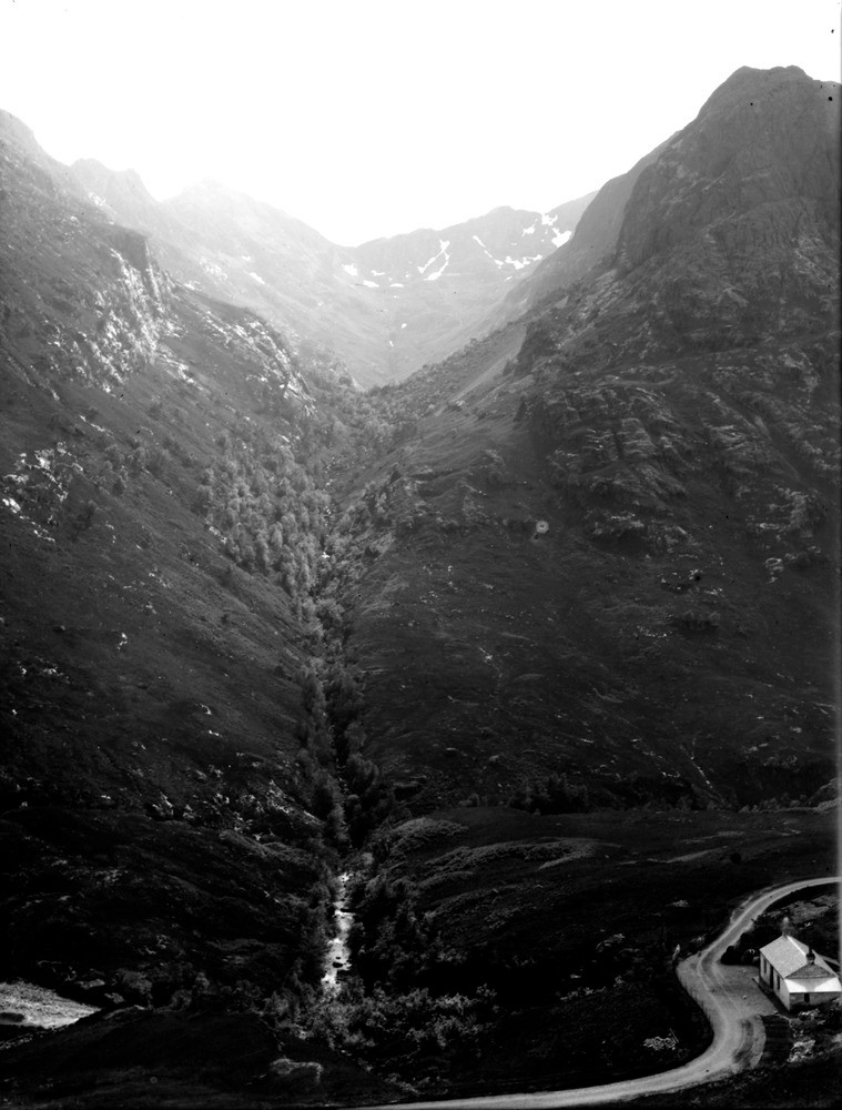
| Caption: | Coire Gabhail, Glen Coe. Argyllshire. Corrie eroded in Lower Old Red Sandstone lavas (basic andesites, rhyolites, and hornblende-andesites). |
| Description: | Coire Gabhail, Glen Coe. Argyllshire. Corrie eroded in Lower Old Red Sandstone lavas (basic andesites, rhyolites, and hornblende-andesites). The straight course of the stream and the grassy hollows forming the crags on the right, are determined by north-north-east dykes; a large landslip from the cliff of rhyolite obstructs the burn. A cottage is seen by the road. A dyke is a sheet-like intrusive igneous body that cuts across the bedding or structural planes of the host rock. Coire Gabhail = corrie of the booty, known as the Lost Valley. |
| Date taken: | Wed Jan 01 00:00:00 GMT 1896 |
| Photographer: | Lunn, R. |
| Copyright statement: | Crown |
| Acknowledgment: | This image was digitized with grant-in-aid from SCRAN the Scottish Cultural Resources Access Network |
| X longitude/easting: | 216500 |
| Y latitude/northing: | 755500 |
| Coordinate reference system, ESPG code: | 27700 (OSGB 1936 / British National Grid) |
| Orientation: | Portrait |
| Size: | 164.49 KB; 759 x 1000 pixels; 64 x 85 mm (print at 300 DPI); 201 x 265 mm (screen at 96 DPI); |
| Average Rating: | Not yet rated |
| Categories: | Unsorted Images, Geoscience subjects/ Igneous features/ Dykes |
Loading...
Loading...
Reviews
There is currently no feedback