| P number: | P000273 |
|---|---|
| Old photograph number: | B00637 |
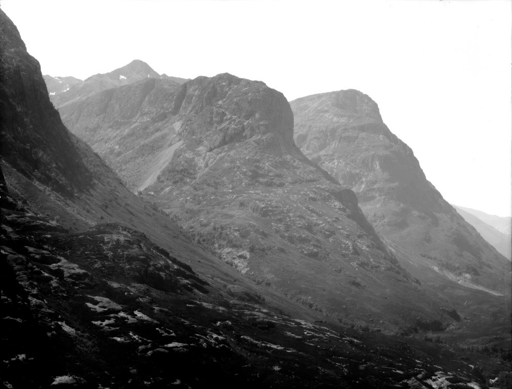
| Caption: | View looking towards Coire Gabhail and Coire nan Lochan, from the north side of Glen Coe. Argyllshire. Aonach Dubh, (868.38 m.) on the right and Gearr Aonach on the left. |
| Description: | View looking towards Coire Gabhail and Coire nan Lochan, from the north side of Glen Coe. Argyllshire. Aonach Dubh, (868.38 m.) on the right and Gearr Aonach on the left. Both consist of thick rhyolite flows above thinner flows of augite-andesite dipping from right to left. The grassy hollows on Gearr Aonach mark the lines of north-north-east - south-south-west porphyrite dykes of the Etive Swarm. The Allt Coire Gabhail itself follows the line of a porphyrite dyke. Note the large landslip in its upper reaches. Landslips are very common in the area. They usually result from instability of valley sides which have been oversteepened by glacial erosion. Slipping in such cases is a step towards re-establishment of gentler gradients. |
| Date taken: | Wed Jan 01 00:00:00 GMT 1896 |
| Photographer: | Lunn, R. |
| Copyright statement: | Crown |
| Acknowledgment: | This image was digitized with grant-in-aid from SCRAN the Scottish Cultural Resources Access Network |
| X longitude/easting: | 215000 |
| Y latitude/northing: | 754500 |
| Coordinate reference system, ESPG code: | 27700 (OSGB 1936 / British National Grid) |
| Orientation: | Landscape |
| Size: | 136.63 KB; 1000 x 759 pixels; 85 x 64 mm (print at 300 DPI); 265 x 201 mm (screen at 96 DPI); |
| Average Rating: | Not yet rated |
| Categories: | Unsorted Images, Geoscience subjects/ Igneous features/ Lava flows |
Loading...
Loading...
Reviews
There is currently no feedback