| P number: | P201176 |
|---|---|
| Old photograph number: | A01187 |
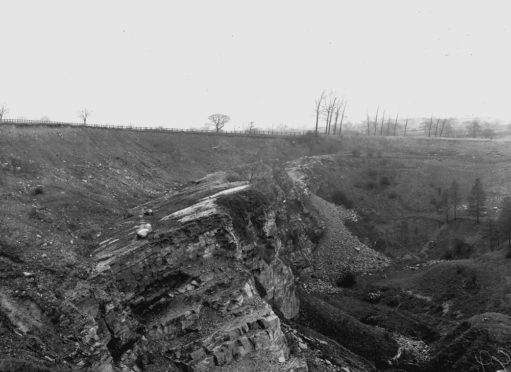
| Caption: | Eastern Quarry, Crich. Looking NW. |
| Description: | Eastern Quarry, Crich. Looking NW. Eastern edge of the same mass of drift banked against the slope of the subsidiary anticline in the limestone in the quarry a short distance east of Hilt's (see No. A1186). About 50 ft. of boulder clay is seen with some north country erratics. Where drift has been banked against the denuded edges of limestone beds and has been stripped off in quarrying, ice scratches are occasionally seen with a trend approximately south-south-east. But the smoothed and striated surface of the limestone slope as seen in the photograph is due solely to slickensiding of the several beds against each other in the process of folding. The limestone here seen is the lower part (D2) of the cherty limestone, with the massive white limestone (D2) below. The photograph shows that the drift entirely obliterated the limestone feature. The rising ground in the distance is the slope of the limestone shales capped by the escarpment of the Kinderscout Grit. |
| Date taken: | Wed May 03 00:00:00 GMT 1911 |
| Photographer: | Rhodes, J. |
| Copyright statement: | Crown |
| X longitude/easting: | 436500 |
| Y latitude/northing: | 354500 |
| Coordinate reference system, ESPG code: | 27700 (OSGB 1936 / British National Grid) |
| Orientation: | Landscape |
| Size: | 227.67 KB; 1001 x 728 pixels; 85 x 62 mm (print at 300 DPI); 265 x 193 mm (screen at 96 DPI); |
| Average Rating: | Not yet rated |
| Categories: | Unsorted Images, Geoscience subjects/ Economic geology/ Cement and lime, limestone quarries and chalk pits |
Loading...
Loading...
Reviews
There is currently no feedback