| P number: | P201175 |
|---|---|
| Old photograph number: | A01186 |
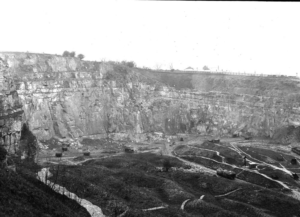
| Caption: | Hilt's Quarry, Crich. Looking NNE. |
| Description: | Hilt's Quarry, Crich. Looking NNE. Upper part of Carboniferous Limestone brought up as an inlier at Crich on the Simoon anticline that extends from Belper through Crich and Ashover. The photograph shows the crest of thin anticline in Hilt's Quarry. The highest limestone seen in the lower part of the cherty limestone (D2), full of Productus giganteus. The massive white limestone (D2) below extends approximately down to the horizon of the upper toadstone, absent at Crich. On the east (right) side drift is banked against the limestone slope. This drift fills in a deep hollow between the main anticlinal limestone ridge, and a second, a short distance further east (see next photo A1187). As seen in Hill's Quarry the drift consists of rubbly boulder clay with boulders of current-bedded sand and gravel in and under it. Several bands of shale, up to 2 feet in thickness are seen in the photograph at the top of the massive limestone on the east side of the quarry. Occasional small solution cavities have formed in the limestone above. One of these caves was proved to open on the preglacial surface of the limestone slope, the entrance being sealed by drift. No bones were found in it. |
| Date taken: | Wed May 03 00:00:00 GMT 1911 |
| Photographer: | Rhodes, J. |
| Copyright statement: | Crown |
| X longitude/easting: | 435500 |
| Y latitude/northing: | 354500 |
| Coordinate reference system, ESPG code: | 27700 (OSGB 1936 / British National Grid) |
| Orientation: | Landscape |
| Size: | 253.96 KB; 1000 x 724 pixels; 85 x 61 mm (print at 300 DPI); 265 x 192 mm (screen at 96 DPI); |
| Average Rating: | Not yet rated |
| Categories: | Unsorted Images, Geoscience subjects/ Economic geology/ Cement and lime, limestone quarries and chalk pits |
Loading...
Loading...
Reviews
There is currently no feedback