| P number: | P201174 |
|---|---|
| Old photograph number: | A01185 |
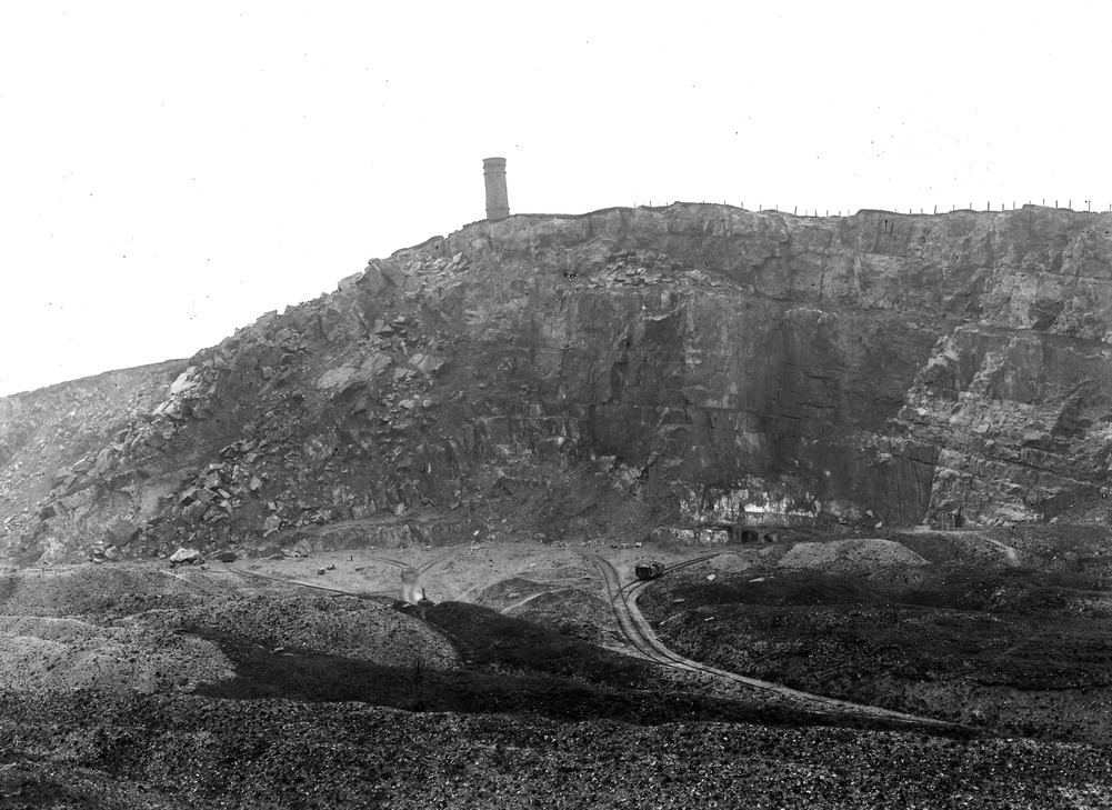
| Caption: | Crich Stand' Quarry. Looking ENE. |
| Description: | Crich Stand' Quarry. Looking ENE. Crest of the main sinuous anticline (see description on No. A1186) in the Crich Stand Quarry. The limestone seen is the white limestone D2 below the cherty beds, but above the lower toadstone. It contains marine bands ('way boards') of dark shale. The tumbled mass on the westward slope is the remnant of a landslip which took place 20 years or more ago, when the limestone at the top of the quarry, sliding upon one of these shale bands in the western limb of the saddle, slipped down into the valley and swept away a cottage. The surface is fissured up to the 'Stand', the tower above the quarry. |
| Date taken: | Wed May 03 00:00:00 GMT 1911 |
| Photographer: | Rhodes, J. |
| Copyright statement: | Crown |
| X longitude/easting: | 435500 |
| Y latitude/northing: | 354500 |
| Coordinate reference system, ESPG code: | 27700 (OSGB 1936 / British National Grid) |
| Orientation: | Landscape |
| Size: | 241.72 KB; 1001 x 729 pixels; 85 x 62 mm (print at 300 DPI); 265 x 193 mm (screen at 96 DPI); |
| Average Rating: | Not yet rated |
| Categories: | Unsorted Images, Geoscience subjects/ Economic geology/ Cement and lime, limestone quarries and chalk pits |
Loading...
Loading...
Reviews
There is currently no feedback