| P number: | P201153 |
|---|---|
| Old photograph number: | A01162 |
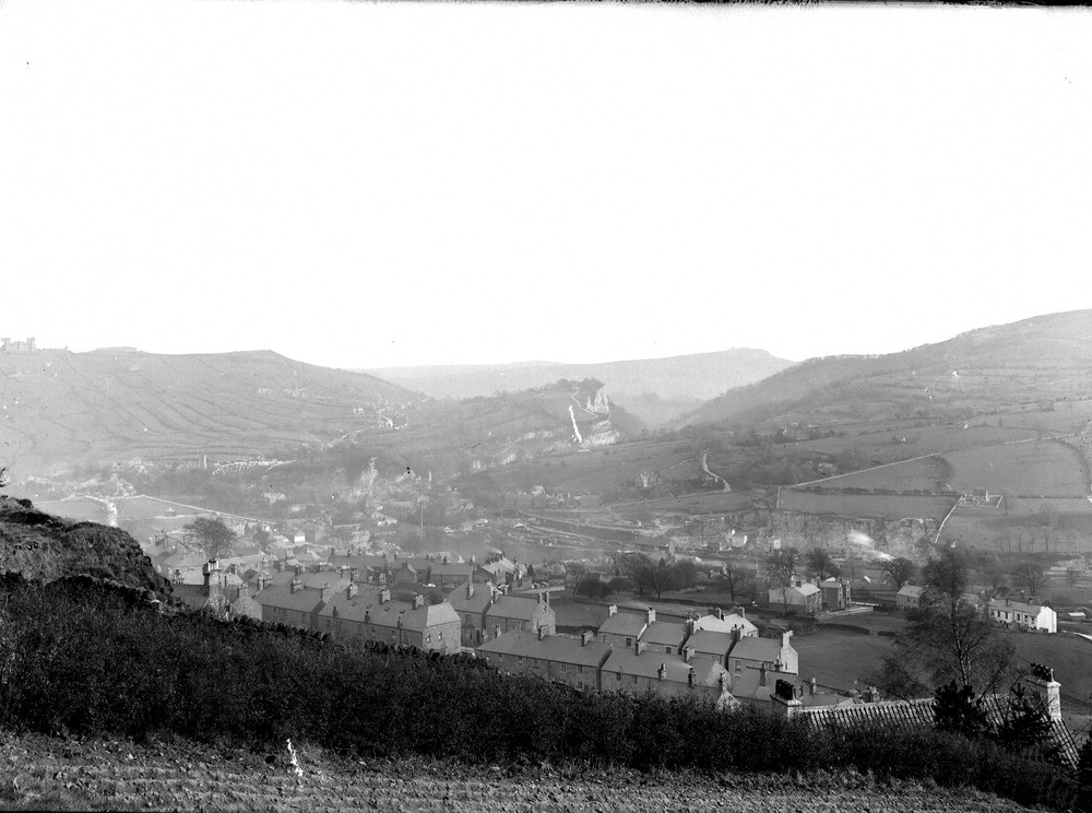
| Caption: | 700 foot contour, N. of Dimple Parish boundary, Matlock. Looking N. |
| Description: | 700 foot contour, N. of Dimple Parish boundary, Matlock. Looking N. General view of the valley and town of Matlock with High Tor beyond. On the skyline on the left is the escarpment of the Kinderscout Grit on Riber Hill with the building known as 'Riber Castle' on the margin of the photograph; in the furtherest distance is the escarpment of the same Grit on Cromford Moor; on the right is the eastward slope of the anticlinal mass of Carboniferous Limestone, rising towards Masson Hill. On the further side of the main valley on the right the Cawdor Limestone Quarries are seen, the limestone there showing a small subsidiary anticline. The Derwent cuts into this anticlinal spur of limestone, but from thence forms a broad alluvial valley in the overlying Limestone Shale before bending sharply westward to enter the High Tor Gorge in the limestone. It is noteworthy that the river takes this course in preference to continuing along the hollow in eroded limestone shale between High Tor and Riber Hill. The explanation is that it first notched the anticlinal limestone at High Tor and became fixed there, at a much earlier stage of denudation, and subsequently moving out further eastwards in the overlying shale before reaching the limestone gorge, to which it was forced to swing back westwards. A similar explanation accounts for its course through the limestone at the Cawdor Quarries. The fresh-looking vertical escarpments of High Tor are maintained by the erosion of the soft-weathering toadstones below on the east side, towards which the slope and dip of the limestone cause the river to press. |
| Date taken: | Thu May 04 00:00:00 GMT 1911 |
| Photographer: | Rhodes, J. |
| Copyright statement: | Crown |
| X longitude/easting: | 428500 |
| Y latitude/northing: | 360500 |
| Coordinate reference system, ESPG code: | 27700 (OSGB 1936 / British National Grid) |
| Orientation: | Landscape |
| Size: | 178.84 KB; 1000 x 744 pixels; 85 x 63 mm (print at 300 DPI); 265 x 197 mm (screen at 96 DPI); |
| Average Rating: | Not yet rated |
| Categories: | Unsorted Images, Geoscience subjects/ Landforms, river/ Escarpments |
Loading...
Loading...
Reviews
There is currently no feedback