| P number: | P201152 |
|---|---|
| Old photograph number: | A01161 |
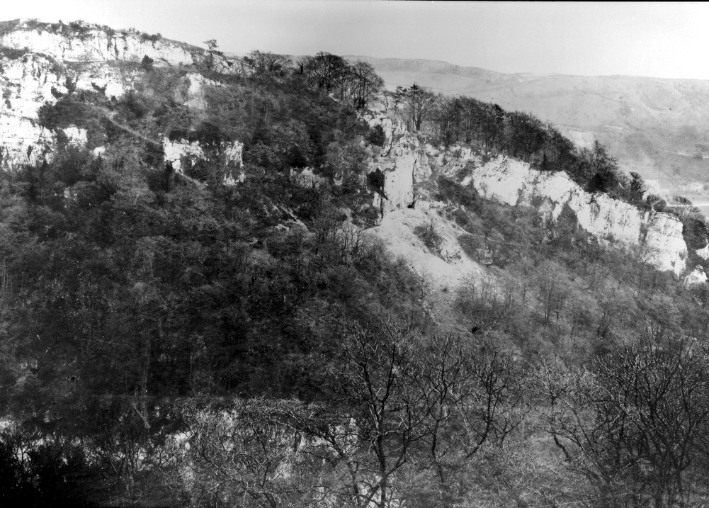
| Caption: | High Tor, Matlock. Looking N. |
| Description: | High Tor, Matlock. Looking N. Continuation of No. A1160, with which this overlaps. South end of the High Tor escarpment, showing the bending down of the part of the cherty limestone (D2) and the massive white limestone (D2) above the upper toadstones are seen, the outcrop of the toadstone being buried under talus. The position of the Great Rake, bearing lead and fluorspar, is marked by the old adit near the middle of the photo. In the distance the escarpment of the Kinderscout Grit is seen on Ratur Hill. |
| Date taken: | Thu May 04 00:00:00 GMT 1911 |
| Photographer: | Rhodes, J. |
| Copyright statement: | Crown |
| X longitude/easting: | 429500 |
| Y latitude/northing: | 359500 |
| Coordinate reference system, ESPG code: | 27700 (OSGB 1936 / British National Grid) |
| Orientation: | Landscape |
| Size: | 275.47 KB; 1001 x 717 pixels; 85 x 61 mm (print at 300 DPI); 265 x 190 mm (screen at 96 DPI); |
| Average Rating: | Not yet rated |
| Categories: | Unsorted Images, Geoscience subjects/ Landforms, river/ Gorges and ravines |
Loading...
Loading...
Reviews
There is currently no feedback